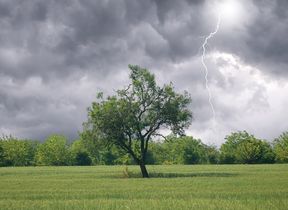
Thunderstorm risk before warmer weather to come
Thundery showers will continue for some in the coming days, while temperatures will rise from the south later this week.
A number of Yellow Warnings for Thunderstorms have been issued by the Met Office for Tuesday, highlighting potential travel disruption and the possibility of some impactful outbreaks of heavy rain with hail and the possibility of lightning.
☂️ Heavy rain continuing to move northeastwards across northern England and into eastern Scotland
— Met Office (@metoffice) June 20, 2023
⛈️ Elsewhere, some heavy showers breaking out with sunny spells
⚠️ Showers could turn thundery with the risk of hail and lightning pic.twitter.com/O8Efc9oRDF
Met Office Chief Meteorologist Steve Willington said: “Thunderstorms will breakout through the day on Tuesday, with our warnings highlighting the most likely locations. While not everywhere will see the most impactful showers, 20-30mm of rain could fall in some spots within an hour, with higher rainfall totals possible if showers were to impact the same place.
“What’s chiefly responsible for these thundery showers is that the UK is under the influence of low pressure, with daytime heating helping to develop unstable air which can be responsible for these bursts of heavy rain.”
The unsettled theme is likely to continue on Wednesday, though the frequency and intensity of showers is expected to be reduced slightly from Tuesday. Showers are most likely to exert their influence more frequently in eastern areas of Scotland, as well as parts of northeast England, south Wales and parts of the southwest. However, many will see a good deal of dry weather on Wednesday, with more settled conditions in the southeast.
A shift in the weather pattern on the way
While some showers could again develop across parts of central and southern England on Thursday, a shift in the weather type is in focus as we head towards the weekend.
Met Office Deputy Chief Meteorologist Steven Keates is providing the medium range forecast. He said: “More of a northwest/southeast split in the UK weather is developing from Friday and into the weekend. High pressure will begin to establish itself from the southeast, allowing a good deal of settled weather through the weekend, with temperatures likely building towards, or slightly exceeding, 30C in some spots.
“However, it’s a much more unsettled picture to the northwest through the weekend, with weather fronts pushing in from the Atlantic bringing more in the way of rain and some gusty coastal winds, especially for those in Scotland and Northern Ireland.”
The more settled conditions for the southern and eastern parts of England through the weekend and into early next week could result in heatwave criteria being met in some spots, though not everywhere is expected to reach their respective threshold for the required three consecutive days.
Glastonbury forecast
With many people heading to Glastonbury ahead of the weekend festival, the forecast is set fair for much of the weekend.
With many people arriving on Thursday, there’s small chance of some residual showers during the day, though things look to be more settled for the weekend. Friday should see a good deal of dry, sunny weather, with temperatures likely to peak around 25C.
There’s an isolated chance of a short shower in the day on Saturday, but the forecast is for a predominantly dry and warm day, with temperatures remaining relatively high overnight. It’s a similar theme on Sunday, with Glastonbury expected to see little in the way of showers and some good periods of very warm sunshine.
Get five top tips on surviving the festival’s weather from Met Office Meteorologist and Presenter Clare Nasir, as part of WeatherReady.
You can check the latest forecast on our website, by following us on Twitter and Facebook, as well as on our mobile app which is available for iPhone from the App store and for Android from the Google Play store. Keep track of current weather warnings on the weather warning page.


