Unsettled start to September
The start of September will bring a spell of unsettled weather, with an uncertain forecast as we move through the week.
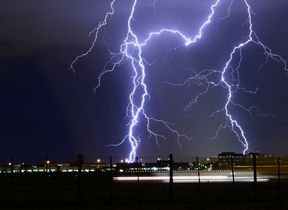
Heavy showers and thunderstorms will impact parts of the UK at the start of this week, a Yellow severe weather warning is in force for Wales, north western England and eastern Scotland through to midnight tonight.
Where these showers and thunderstorms develop some places may see 30 to 40mm of rain in less than an hour and perhaps 60-80mm in one or two places. As ever with thunderstorms, not everywhere within the warning area will see the heavy showers.
⚠️ Yellow weather warning UPDATED⚠️
— Met Office (@metoffice) September 2, 2024
Thunderstorms across parts of the UK
NOW – 23:59
Latest info 👉 https://t.co/QwDLMfRBfs
Stay #WeatherAware⚠️ pic.twitter.com/byJ5QUV89A
Through the night, the heavy rain and thunderstorms across Scotland will clear to the north, whilst heavy showers over central parts of England may be slower to die out. This leaves Tuesday as a largely cloudy day with further showers in Northern Ireland, western Scotland and south eastern England, whilst some sunshine is likely elsewhere and it will feel fresher.
After a chilly start in the north on Wednesday morning, it will be a day of sunshine and showers across much of the UK, with more widespread cloud across central and northern Scotland. Some of the showers could be heavy and, with light winds, they will be slow moving.
Uncertain from the middle of the week
Beyond the middle of the week the forecast for the UK is unusually uncertain, though the most likely scenario will see warm air returning across at least southern and perhaps central regions bringing cloud, additional rainfall and the risk of a few thunderstorms. Further north it will likely be brighter will a greater influence of higher pressure to the north of the UK.
Met Office Deputy Chief Meteorologist, Nick Silkstone, explains: “The forecast for the UK past the middle of the week is still uncertain, with a complex jet stream interaction taking place, and this determining the relative position of areas of high and low pressure relative to the UK. It is most probable high pressure will sit to the north of the UK, with lower pressure to the south allowing cloudier conditions, outbreaks of rain and the potential for further thunderstorms in the south, while further north more settled and brighter conditions are most probable.”
Nick continued: “Less likely scenarios include the high pressure building more widely across the UK which would lead to more settled conditions and sunny spells, and there are other outcomes that lie between the two illustrated here. This complex jet stream interaction which drives these potential different directions the UK weather could take, will mostly conclude by late Tuesday, which will lead to us being able to identify the winning scenario by that point.”
Stay up to date
While the weather for later this week is uncertain it is best to keep a close eye on the forecast to see how things will develop. It is possible that warnings could be issued or amended through the week.
You can find the latest forecast on our website, on YouTube by following us, on Twitter and Facebook, as well as on our mobile app which is available for iPhone from the App store and for Android from the Google Play store.


