Hot, humid and thundery in places this week
Author: Press Office
11:23 (UTC+1) on Thu 20 Jun 2019
The Met Office is forecasting a period of hot and humid weather this week, with the potential for locally severe thunderstorms developing in places.
Several National Severe Weather warnings for thunderstorms and heavy rain have been issued for parts of the UK from Monday, as well as Heat Health alerts issued in conjunction with Public Health England.
Met Office Chief Meteorologist, Dan Suri, said: “It’s going to feel much hotter for most areas across the UK this week. Our latest forecasts show the highest temperatures are expected towards the end of the week, most likely across central and southwest England, where temperatures could rise into the low 30s Celsius.
“This will be in stark contrast to the low temperatures we’ve had so far this June. It’s also going to feel humid and quite muggy - especially at night time - as temperatures could remain in the high teens or low 20s Celsius in places.”
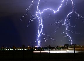
In addition to the high temperatures, there is a widespread risk of severe thunderstorms with several National Severe Weather warnings in place for large parts of the country. Dan continued: “Whilst some places within warning areas could miss thunderstorms altogether and enjoy a warm, bright day, where they do develop torrential downpours, hail, lightning and gusty winds are likely and a few spots could see as much as 40-60mm of rain in one hour – which is very unusual for the UK.
Commenting on the potential impacts from these thunderstorm, Dan said: “With the potential for a large volume of water in a short time, there is a significant risk of flash flooding, fast flowing or deep flowing water causing danger to life and very difficult driving conditions in places.”
“As such we are urging the public to keep a close eye on our forecasts and warnings, especially on Met Office social media and video broadcasts as these will capture the latest details for your area.”
Why are we getting this change in weather?
For most of this month an omega blocking pattern in the north Atlantic means the UK has been stuck under an area of low pressure, bringing spells of heavy rain and thunderstorms. Over the next few days this omega block will shift slightly, nudging the centre of the low pressure to the southwest of the UK. This small change will allow very warm air to be drawn upwards from southern Europe and north Africa towards northern Europe, the UK and Ireland. High temperatures are expected across parts of western Europe, with the possibility of near record-breaking June temperatures in countries including France, Germany and the Netherlands.
Updated at 10:33 (UTC+1) on Sun 23 Jun 2019


