Wet weekend ahead following Storm Alex – October 2020
Author: Press Office
12:14 (UTC+1) on Thu 1 Oct 2020
Storm Alex will bring wet and windy weather to southern parts of the UK on Friday, followed by a very wet weekend for many.
National Severe Weather Warning
The Met Office has issued a rain and wind warning for southern parts of the UK tomorrow (Friday), as Storm Alex, a weather system named by Météo-France earlier this week, clips the southern edge of Britain.
Heavy rain and strong wind in areas
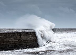
Steve Ramsdale, Chief Meteorologist at the Met Office, said: “It’ll be quite a miserable end to the working week for southern and south-west England as Storm Alex brings heavy rain and strong winds tomorrow, with coastal gales of around 60-65mph for some.
“Away from the south it’ll be a more pleasant day, with light winds and bright spells for much of northern England, Scotland and Northern Ireland. However, as the strong winds and rain associated with Storm Alex clear away from Britain later on Friday, another low-pressure system moves towards the UK from the east bringing further very heavy rain and strong winds to many over the weekend.”
Weekend weather
Deputy Chief Meteorologist at the Met Office, Nick Silkstone, said: “Saturday will be a very wet day as heavy bands of rain push north and west across the country, followed by showery rain on Sunday. It’ll be cold and windy too with a risk of coastal gales in some areas. The Met Office has issued a rain warning covering large parts of the country over the weekend and we’re urging people to keep a close eye on the weather forecast and warnings during this spell of disruptive weather.”
Flood risk
Parts of Wales, southwest England and eastern Scotland could see over 100mm of rain falling over the weekend, which is likely to lead to significant impacts from flooding, an enhanced risk of landslides along with very difficult driving conditions.
Environment Agency
Jonathan Day, Flood Duty Manager at the Environment Agency, said: “Heavy rain will bring the potential for surface water flooding and perhaps some river flooding across the south of England on Friday. More widespread and persistent heavy rain across much of England will bring the potential for further river and surface water flooding over the weekend.
“Environment Agency teams have been working hard to clear grills and weed screens in areas which may be affected, and are ready to support local authorities leading on responses to surface water flooding incidents, should they occur. We urge people to stay away from swollen rivers and not to drive though flood water – it is often deeper than it looks and just 30cm of flowing water is enough to float your car.
Sign up for free flood warnings
“You can check your flood risk, sign up for free flood warnings and keep up to date with the latest situation at https://www.gov.uk/check-flood-risk, call Floodline on 0345 988 1188 or follow @EnvAgency on Twitter for the latest flood updates.”
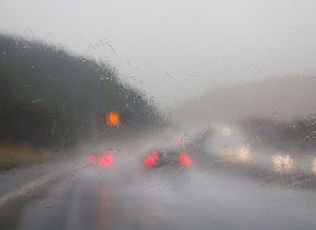
RAC Breakdown spokesperson Rod Dennis said: “Heavy rain will make road conditions miserable if not downright dangerous for drivers this weekend, and they’ll need to be prepared for an ugly mix of surface spray, gusty winds and more than likely some disruption on the roads.
“Floods are also a possibility so drivers should remember never to attempt to drive through water unless they know for sure that it’s shallow enough. For drivers who are unlucky enough to breakdown in the horrid conditions, our patrols will be working around the clock to get them moving again.”
Stay connected
You can check the latest weather warnings on our severe weather warnings pages and you can get the most accurate and up to date forecast for your area using our forecast pages and by following us on Twitter and Facebook, as well as using our mobile app which is available for iPhone from the App store and for Android from the Google Play store. Whatever the weather we are all being urged to remember the Government Coronavirus guidelines.
Updated at 12:14 (UTC+1) on Thu 1 Oct 2020


