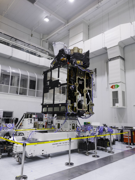
Satellite marks next generation of weather forecasting
Author: Press Office
00:01 (UTC) on Tue 13 Dec 2022
A multi-year project to improve weather forecasting and climate monitoring starts today (13 December), with the launch of a new satellite by EUMETSAT and the European Space Agency (ESA).
Launching from French Guiana, the Meteosat Third Generation Imager (MTG-I1) is the first satellite to be launched as part of a wider project to revolutionise and safeguard weather forecasting across Europe for the next 20 years, improving short-term weather forecasting, as well as long-term climate monitoring.
The imaging satellite is the first in a series of six satellites to launch as part of the project.
Satellite data is the largest contributor to numerical weather prediction accuracy and imagery is used by meteorologists to assess developing weather patterns.
Positioned 36,000km above the Earth and providing a view of Europe and Africa, MTG-I1 will host the first ever lightning imager covering the region, vastly improving short-range ‘nowcasting’ for developing impactful convective systems.
The satellite also carries a visible and infrared imager. Imagery from the satellite will be available more frequently and at a higher resolution for meteorologists, giving an improved view of the state of the Earth’s current weather patterns to improve forecast accuracy. Full Earth disc satellite images will be available 33% more frequently (now every 10 minutes), with imagery providing resolution of up to 500m on some channels, and between 1 and 2km on other channels.
Once fully operational, images and data from MTG-I1 will be available to all EUMETSAT members, which comprises 30 national meteorological services, of which the Met Office represents the UK’s interests.

Met Office Head of Space Applications and Nowcasting R&D Simon Keogh said: “We’re hugely excited about the benefits that the MTG-I1 satellite will bring to our forecast accuracy, which will continue to evolve as the subsequent MTG satellite launches take place in the coming years.
“A dedicated lightning imager over Europe and Africa will vastly improve our short-range forecasting, helping us to identify and track impactful storms, particularly rapidly developing, multi-hazard storms that can bring not only lightning but also strong winds, hail and heavy rainfall. The improved frequency and resolution of imagery will allow our meteorologists access to the best possible information on the current state of the atmosphere, which is crucial in creating accurate weather forecasts. More frequent and detailed imagery will also improve our meteorologists’ confidence around issuing short-range severe weather warnings.
“We’re excited to keep working with EUMETSAT and ESA as the MTG mission continues in the coming years with further satellite launches.”
EUMETSAT Director General Phil Evans said: “The Meteosat Third Generation (MTG) system is the most complex and innovative geostationary meteorological satellite system ever built. The purpose of this multi-billion-euro investment is to provide meteorological services in our member states with a vastly increased amount of more precise information which will help them protect lives, property and infrastructure. This system will, literally, save lives.”
Paul Blythe, ESA’s Meteosat Programme Manager, said: “After over a decade of close cooperation and hard work of all involved, to see the first of the MTG-I satellites take to the skies is a profound experience for me. With the satellite’s innovative design and its novel lightning imager, MTG will push short term weather forecasting into the future. I look forward to seeing how brand-new data from this satellite will be integrated into our sophisticated users’ systems such as the Met Office.”
Once MTG-I1 is in position, the Met Office will be contributing to quality assurance tests of the new satellite and providing feedback to EUMETSAT. The satellite is expected to be fully operational for all members approximately a year from launch.
MTG-I1 is the first of six satellites to launch, including four imagers and two sounders. The mission is jointly led by EUMETSAT and ESA, with the aim of improving both long-term and short-term weather forecasting, as well as long-term climate monitoring.
The next launch, which will be a sounding satellite that profiles the state of the atmosphere at different heights, is scheduled to take place in 2024.


