Mild and wet turning to cold with a chance of snow
Author: Press Office
12:22 (UTC) on Fri 13 Jan 2023
After another wet and windy weekend ahead, colder conditions will move in across the UK.
Rain and strong winds will once again sweep across the UK overnight on Friday and through Saturday morning with the potential for 60-70 mm of rain over the high ground of South Wales. Yellow warnings for rain have been issued for Wales and western parts of England. A Yellow warning for wind and rain has also been issued for Northern Ireland from Saturday afternoon through to the early hours of Sunday morning. Gusts could reach up to 65 mph while rainfall totals could reach 40-50 mm over higher ground in the north.
Low pressure will drive a wide area of rainfall and gusty winds across the UK through Friday night and Saturday morning. The strongest wind and rain will clear England and Wales by mid-afternoon leaving occasional blustery showers.
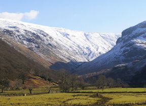
Further north, it will turn colder with showers turning to snow over high ground.
Chief Meteorologist, Andy Page, said: “After what has already been a wet start to January, further wet and windy conditions will move across the UK this weekend. With the ground already saturated in parts of the UK this additional rainfall could bring disruption, particularly in the west. Check online to for the latest flood warnings in your area.”
Mark Garratt, Flood Duty Manager at the Environment Agency, said: “Continued heavy rainfall means that local minor surface water and river flooding is probable in parts of the West Midlands on Friday, with further impacts likely in parts of South West England on Saturday, and further minor impacts likely in the South and North West over the weekend. With the ground saturated, communities in these areas should check their flood risk.
“The Environment Agency is monitoring flood levels, operating flood gates and barriers at locations across the country, and ensuring debris screens are clear from blockages to ensure communities are better protected. We advise people to stay away from swollen rivers and urge people not to drive through flood water as just 30cm of flowing water is enough to move your car.
“People should check their flood risk, sign up for free flood warnings and keep up to date with the latest situation at https://www.gov.uk/check-flood-risk, call Floodline on 0345 988 1188 or follow @EnvAgency on Twitter for the latest flood updates.”
Turning colder
As the area of low pressure moves away into the North Sea, it starts to pull down a cooler pool of air with a northerly flow developing in the north of the UK through Saturday evening.
By Sunday most of the UK will be in the northerly airflow, with lower temperatures spreading further south overnight. Showers will fall increasingly as sleet and snow in the north, even to lower levels. Some showers further South and West, and perhaps a more persistent spell of rain overnight into Monday, could also turn to sleet and snow mainly over high ground such as the Brecon Beacons, Exmoor and Dartmoor.
Overnight frost will become more widespread by Monday night, with overnight temperatures below 0°C across much of the UK. Temperatures could get down to -10°C in sheltered glens, or across high ground areas of Scotland where there is lying snow.
Deputy Chief Meteorologist, Helen Caughey, said: “After a spell of wet and mild weather to start 2023, a brief cold spell will change the feel of our weather across the UK for a few days next week. As a northerly flow establishes, we’ll see temperatures decline with overnight frosts returning and the chance of wintry showers in the north. It will certainly feel cold in all regions too, with the northerly winds creating a notable windchill.”
The colder spell is expected to be short lived, with milder air moving in from the Atlantic bringing wet and windy conditions back to the UK towards the end of the week. There is a chance of some transient snow on the leading edge of the frontal rain as it moves through however the detail on this is currently uncertain.
Keep up to date with the latest forecast on our website, by following us on Twitter and Facebook, as well as on our mobile app which is available for iPhone from the App store and for Android from the Google Play store. Keep track of current weather warnings on the weather warning page.


