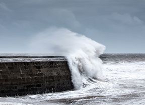
Storm Henk named by Met Office
Author: Press Office
09:01 (UTC) on Tue 2 Jan 2024
Storm Henk will bring a spell of very strong winds to parts of the UK leading to potential disruption to travel and infrastructure.
An area of low pressure crossing southern regions of the UK, now named Storm Henk, will bring an area of very strong winds through Tuesday. Initially the strongest gusts will be focused around southwest England and south Wales during the late morning and early afternoon. Here gusts of up to 80mph are possible in exposed coastal locations.
As the low pressure moves north-eastwards the strongest wind gusts also move eastwards across the UK with many parts of southern England, the south Midlands and East Anglia experiencing 50-60mph gusts through the afternoon and evening. Inland gusts could reach up to 60-70mph in one or two places for a time.
An Amber severe weather warning for wind has been issued for these regions from 10:00 this morning through to 20:00 this evening. A wider Yellow severe weather warning for wind covers the whole of southern England and Wales.
A Yellow warning for rain covers a wide area of England and Wales as further rain moves in through the day. Rainfall totals from 17:00 on Monday to 21:00 Tuesday are likely to reach 15-30mm with 35-50mm in a few places.
#StormHenk has been named and is forecast to bring very strong winds and heavy rain to parts of southern Britain through the day today
— Met Office (@metoffice) January 2, 2024
⚠️ Stay #WeatherAware pic.twitter.com/tosSdVNfsY
It will also be windy in the very far northeast of the UK with some snowfall over Shetland later in the afternoon.
Met Office Chief Meteorologist Paul Gundersen, said: “Further wet and windy weather is forecast for the UK this week. Our latest analysis of the forecast shows an increase in the likelihood of very strong wind gusts across parts of southern Wales and England which is why we have issued this Amber warning this morning and named Storm Henk.
“Storm Henk will initially bring very strong winds to the southwest of England and Southern Wales, with gusts of up to 80mph possible. As Storm Henk moves north-eastwards across the south of the UK through Tuesday the strongest winds will also move eastwards, across the south Midlands, Home Counties and East Anglia through the afternoon and evening.”
Further ahead
The weather across the UK is forecast to remain unsettled through this week with westerly Atlantic conditions in charge. As we move through the weekend and into next week there are early signs of higher pressure developing which would settle the weather down and bring a spell of lower temperatures.
You can keep up to date with the latest forecast on our website, by following us on Twitter and Facebook, as well as on our mobile app which is available for iPhone from the App store and for Android from the Google Play store.


