Warnings issued ahead of thunder risk
Author: Press Office
10:46 (UTC+1) on Sun 11 Jun 2023
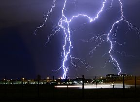
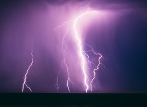
Yellow Weather Warnings have been issued for thunderstorms by the Met Office, as a plume of warm air will raise temperatures and increase the risk of thundery showers.
The area of high pressure which has been responsible for the last couple of weeks of settled weather for much of the UK will drift away towards Scandinavia, allowing a plume of warmer, humid air from the south to influence the weekend weather for much of the UK.
Temperatures will begin to climb from Friday as the warmer air pushes in from the south, bringing with it the chance of some evening and overnight showers in the southwest of England and southern Wales.
As this warmer air pushes further north and east through the weekend, temperatures will rise triggering widespread thundery showers by Saturday afternoon and again on Sunday. These will bring the chance of hail and gusty winds for some places, as well as torrential downpours for a few. This will be the first meaningful rainfall for many places across the UK for several weeks. As is often the case, many places will either miss the worst of any thunderstorms, some staying dry altogether, just a few locations catching the intense downpours.
A Yellow Warning for thunderstorms has been issued, covering Wales and a large area of southern and central England from 1400 to 2100 on Saturday. The warning highlights potential disruption to travel, the chance of power cuts and the possibility of very localised flooding from the heaviest showers.
⚠️ Yellow weather warning issued ⚠️
— Met Office (@metoffice) June 8, 2023
Heavy showers and thunderstorms across Wales and parts of southern and central England
Saturday 1400 – 2100
Latest info 👉 https://t.co/QwDLMfRBfs
Stay #WeatherAware⚠️ pic.twitter.com/VyysJZlcS5
Met Office Chief Meteorologist Frank Saunders, said: “Temperatures will increase into the weekend with a peak of 31°C expected on Saturday in central and southeast England. As the heat builds from the south, thundery showers will develop through Saturday afternoon and while not everyone in the warning area will see the heaviest showers, or even any rain at all, some will bring heavy thundery downpours. With intense showers there is a risk of surface water flooding which could cause some disruption – the very dry, baked ground may not help in that respect.”
A second Yellow warning for thunderstorms has been issued for Sunday between 1200 and 2100, covering a large area of the UK including parts of Wales, England, Northern Ireland and Scotland. Frank added: “The heat will last for a few more days at least, Sunday will see 30°C again in parts of southern UK and the risk of thunderstorms also spreads more widely across the UK – particularly western and central areas – with heavy downpours again brining the risk of thunder, hail and gusty winds. As well as higher daytime temperatures, overnight temperatures will also climb with some locations not getting below the mid-teens °C overnight.”
⚠️ Yellow weather warning issued ⚠️
— Met Office (@metoffice) June 9, 2023
Heavy showers and thunderstorms across England, Wales, Scotland and Northern Ireland
Sunday 1200 – 2100
Latest info 👉 https://t.co/QwDLMfRBfs
Stay #WeatherAware⚠️ pic.twitter.com/uHRrcQWTfl
East and northeast Scotland are likely to be the main exception to the change in conditions, with an easterly breeze possibly keeping temperatures more subdued with cloud likely to persist for some. Some coastal areas will be cooler than the peak figures further inland, with sea breezes off the North Sea preventing the highest temperatures building on immediate coastlines.
Heat Health Alert
The UK Health Security Agency, which covers the healthcare sector in England, has issued a Heat Health Alert.
Dr Agostinho Sousa, Head of Extreme Events and Health Protection at the UK Health Security Agency, said: “In the coming days we are likely to experience our first sustained period of hot weather of the year so far, so it’s important that everyone ensures they keep hydrated and cool while enjoying the sun.
“Forecasted temperatures this week will primarily impact those over the age of 65 or those with pre-existing health conditions such as respiratory and cardiovascular diseases.
“If you have friends, family or neighbours who you know are more vulnerable to the effects of hot weather, it is important you check in on them and ensure they are aware of the forecasts and are following the necessary advice.”
Don’t forget animals can struggle with heat
It isn’t just humans that can suffer in higher temperatures, British Veterinary Association Junior Vice President Anna Judson said: “Here in the UK we get very excited by the promise of a bit of lovely, sunny weather but we mustn’t forget that animals can struggle when temperatures heat up. Pet owners should take extra precautions to ensure their pets are cool, hydrated, and safe from the sun.
“This includes making sure pets aren’t walked or exercised during the heat of the day or left inside a car, caravan or conservatory, even for a little while, as ‘not long’ can prove fatal. Make sure pets have access to fresh drinking water, good ventilation and shade from direct sunlight at all times and call your vet immediately in case of any concerns about their health.”
Dry Scotland
Although some places in Scotland could see scattered showers through the latter half of the weekend, it isn’t likely to deliver much rainfall over a wide area. After the showers diminish through the start of next week, Scotland continues to see a relatively dry forecast, following a prolonged dry spell. The Scottish Environment Protection Agency (SEPA) has raised the risk of water scarcity around the Loch Maree area in the Highlands to Significant, the highest level available.
Nathan Critchlow-Watton, Head of Water and Planning at SEPA, said: “For the risk of water scarcity to have reached significant this early in the summer is extremely concerning and leaves no doubt that the next few months are going to be very challenging for all those who rely on the water environment to run their business.
“While water levels are critical in this part of the Highlands, we can see other areas of Scotland are on the same trajectory and it’s vital that businesses take steps now to maximise the resource available and prevent further environmental harm.”
Further ahead
Signals for next week indicate the risk of thundery downpours will continue at first for some with temperatures likely to remain above average. Eastern coastal areas could be slightly cooler again, with a resumption of an easterly breeze. For the latest outlook further ahead, watch our latest 10 Day Trend below.
You can check the latest forecast on our website, by following us on Twitter and Facebook, as well as on our mobile app which is available for iPhone from the App store and for Android from the Google Play store. Keep track of current weather warnings on the weather warning page.


