Warm for many with a change on the way
Author: Press Office
12:14 (UTC+1) on Fri 10 May 2024
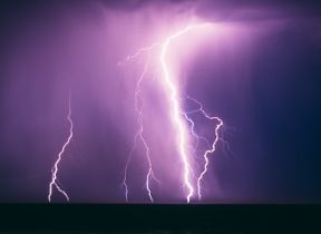
Warm and settled conditions will subside later this weekend, with thunderstorms likely for some from Sunday.
Although temperatures may reach 27°C for some this weekend, the Met Office have issued yellow thunderstorm warnings for Sunday. They cover a large part of England and Wales from 12 noon until 22:00, parts of Northern Ireland from 11:00 until 19:00 and parts of Scotland from 14:00 until 04:00 Monday morning.
⚠️ Yellow weather warning issued ⚠️
— Met Office (@metoffice) May 10, 2024
Thunderstorms across parts of western and central England and Wales
Sunday 1200 – 2200
Latest info 👉 https://t.co/QwDLMfRBfs
Stay #WeatherAware⚠️ pic.twitter.com/v83CSEMq5A
⚠️ Yellow weather warning issued ⚠️
— Met Office (@metoffice) May 10, 2024
Thunderstorms across parts of Northern Ireland
Sunday 1100 – 1900
Latest info 👉 https://t.co/QwDLMfRBfs
Stay #WeatherAware⚠️ pic.twitter.com/TDI4n40esB
⚠️ Yellow weather warning issued ⚠️
— Met Office (@metoffice) May 11, 2024
Heavy showers and thunderstorms across parts of Scotland
Sunday 1400 – Monday 0400
Latest info 👉 https://t.co/QwDLMfRBfs
Stay #WeatherAware⚠️ pic.twitter.com/FipqrXRFJA
High temperatures over the weekend
Locations in the southeast could see 26°C, possibly 27°C on Sunday. The warm weather brings an increase in both UV and pollen levels. You can see the latest pollen forecast and UV ratings on our app or website.
Good news for some... As tree pollen continues to decline and grass pollen slowly increases, counts for many today will be in the low to moderate category 🤧 pic.twitter.com/7dFHlQ2fLD
— Met Office (@metoffice) May 11, 2024
Turning unsettled from Sunday
We’ll start to see things break down from Sunday, as an area of low pressure moves into the southwest bringing heavy showers and thunderstorms. It will be a fine start for many, although some mist and low cloud may affect some coastal areas in the northeast. Cloud will then increase from the southwest, bringing with it a change in conditions.
Deputy Chief Meteorologist Dan Harris said: “Heavy showers and thunderstorms are likely to break out on Sunday morning, most likely across southwest England and Wales, but possibly also across western Northern Ireland too. They’ll track steadily north through the afternoon whilst probably growing into larger clumps of rain before clearing Scotland overnight.
“Some intense downpours are possible in a few places, giving up to 30mm in less than hour and perhaps 40-50mm over two to three hours. Hail, frequent lightning strikes and strong wind gusts will be additional localised hazards.”
Asthma and thunderstorms
Thunderstorms can in some cases trigger asthma, causing asthma attacks and making symptoms like breathlessness, wheezing and coughing worse. Asthma and Lung UK have advice on how to protect yourself if you suffer from asthma:
- keep managing your asthma well.
- stay indoors before, during and after thunderstorms. It’s a good idea to keep your windows closed too.
- if you have to go outside, wear a mask to protect yourself against pollen grains.
- if you have hay fever, take hay fever medicines to help protect yourself against pollen.
- always keep your reliever inhaler with you, so that you can use it to quickly treat asthma symptoms in an emergency.
You can read more about thunderstorm asthma and public health in this UK Health Security Agency blog article.
Low pressure in charge next week
Low pressure will be firmly in charge from the start of next week, bringing widely wet and unsettled conditions. Things will also turn cooler through Monday, with temperatures nearer average for much of next week.
Aurora sightings
Geomagnetic activity on Friday night was very strong, the highest recording in the UK since 2003. This resulted in some very vivid Aurora sightings across the UK with clear skies for many.
While short nights limit the visibility window, there’s a good chance of sightings on Saturday night, especially across Scotland, Northern Ireland and parts of northern England and Wales. There could be some visibility further south, especially with long-exposure cameras.
Aurora visibility is likely to persist through Sunday night, though there will be much more cloud across the UK especially in the west. Areas in the East of the UK have the better chance of clear skies and the possibility of seeing Aurora.
Overnight, we experienced the first Extreme Geomagnetic Storm since 2003.
— Met Office (@metoffice) May 11, 2024
We received hundreds of wonderful images of the northern lights from right across the UK, so here are just a few of them @ishantanu_ @TraceyBtint @PJPolarBear1 @olemonka 👇 pic.twitter.com/kcXUizU19X
Met Office Space Weather Manager Krista Hammond said: "Multiple coronal mass ejections from the Sun are expected to reach Earth in the coming days bringing the potential for aurora visibility over the UK. Aurora visibility may persist through Saturday night, but as it stands this is likely to be less widespread than on Friday night with northern parts of the UK most likely to continue to have the best viewing potential."
The Met Office Space Weather Operations Centre will continue to monitor the conditions on the Sun for any further Earth-directed solar storms in the coming days, with the possibility of more solar flares and coronal mass ejections in the coming days. The enhanced activity from the Sun coincides with an expected solar maximum this year, as part of the Sun's approximate 11-year solar cycle.
You can find the latest forecast on our website, on YouTube by following us, on Twitter and Facebook, as well as on our mobile app which is available for iPhone from the App store and for Android from the Google Play store.


