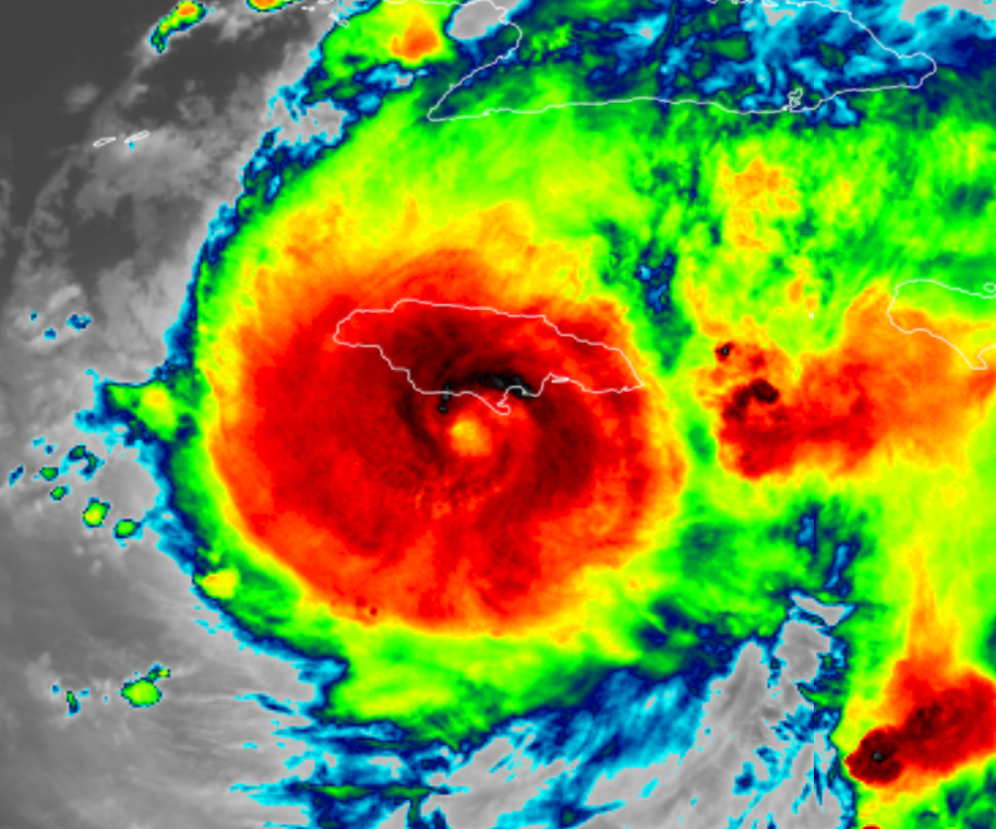
Hurricane Beryl, which has been tearing through the Caribbean, has been hitting the headlines for several reasons.
Firstly, there is the undeniable fact that during her existence as a Category 4 and 5 hurricane Beryl caused much damage and loss of life across several nations and territories, including Grenada, St Vincent and the Grenadines, Jamaica and the British Overseas Territory of the Cayman Islands.

Secondly, Beryl has become infamous for being the earliest Category 5 hurricane in the historical record in the Atlantic Basin. Category 5 is the highest ranking for hurricanes requiring sustained wind speeds of at least 157 mph. Hurricane Beryl’s wind actually peaked at 165 mph on 2 July. The earliest date in the year any previous Atlantic hurricane had achieved winds of this strength was a full month later on 5 August.
Active hurricane season
Julian Heming is a Met Office tropical cyclone expert who has been studying these systems for many years. He said: “In the second half of May several prediction centres, including the Met Office, forecast an active Atlantic hurricane season with between 150% and 200% of usual activity.
“These Atlantic seasonal forecasts have been influenced by the development of cooler waters in the equatorial eastern Pacific in recent months – in line with the anticipated La Niña or cooler phase of the naturally-variable El Niño Southern Oscillation (ENSO) cycle.
“Developing La Niña conditions have a known association with a more active Atlantic hurricane season. So, we know that natural variation in the climate system has a huge observable effect on hurricane activity.
“But this trend towards La Niña favouring hurricane development would not solely explain Hurricane Beryl and the prediction of an active hurricane season.
“Sea temperatures across the tropical Atlantic and Caribbean Sea have been well above average since the Spring of 2023 which provides fuel for intense hurricanes like Beryl. There is much meteorologists do not yet understand about how these high sea-surface temperatures have developed and why they have persisted for so long. This is an active area of research.”
“Furthermore, higher sea-surface temperatures in line with a warming climate are expected to favour the development of a greater proportion of intense tropical cyclones in the long term.”
International effort
Will Lang is the Met Office’s head of Situational Awareness. He said: “Met Office forecasts are a crucial part of the international effort to predict Atlantic hurricanes, and our experts work at the heart of UK Government’s international response to damaging hurricanes such as Beryl.”
You can watch an interview about Hurricane Beryl here.


