Satellite image of the month - 2023
Showcasing some of the Met Office's satellite imagery from around the world showing weather in action, new views of the world and extra commentary on how we collect and create the images from our Space Applications team.
December 2023 - Tropical Cyclone Jasper
8 December 2023
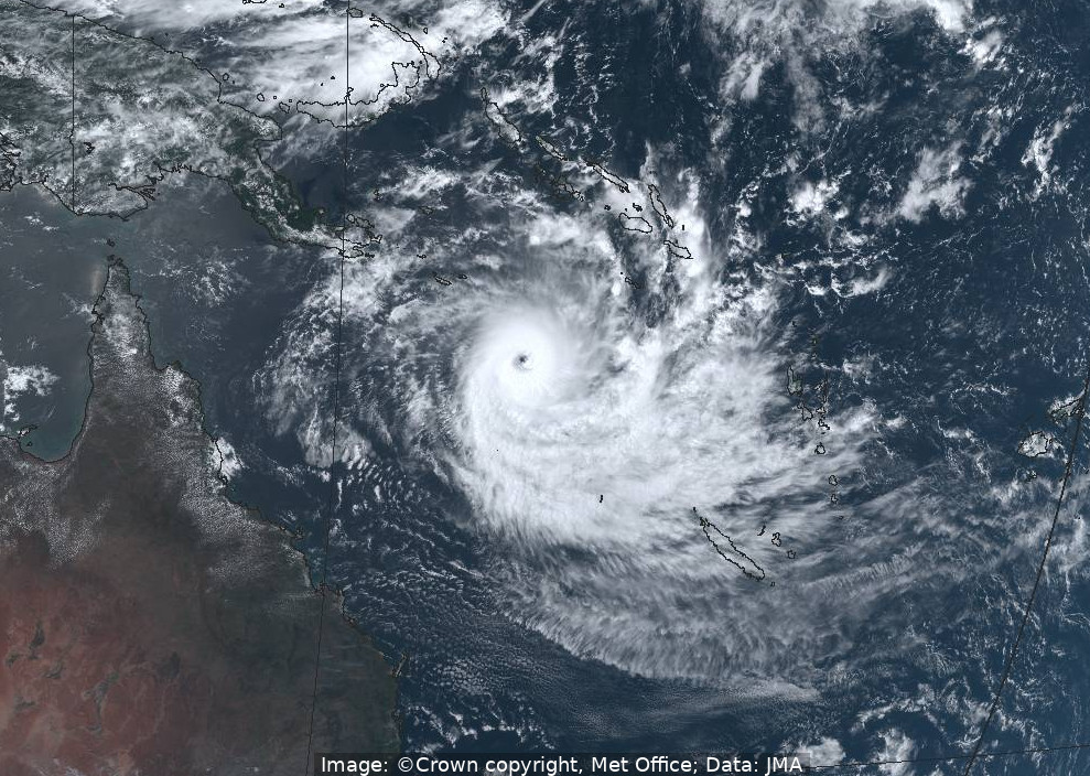
The middle of December 2023 saw Tropical Cyclone Jasper bring large amounts of rainfall to north-east Australia. The above image, a true-colour composite from JMA's Himawari-9 satellite, was captured at around 0230 UTC on 8 December 2023, when the cyclone was near its peak intensity. By the time it made landfall near Port Douglas on 13 December its intensity had reduced significantly, but the storm's westward movement then slowed significantly, resulting in heavy precipitation falling along Queensland's east coast for several days. Rainfall estimates, taken from both surface-based gauges and satellite measurements, indicated monthly precipitation totals of 60 cm or more along sections of the coast north of Cairns, with the Australian Bureau of Meteorology reporting 5-day rainfall totals (between 13 and 18 December) as locally exceeding 150 cm.
Credits: Image: © Crown copyright, Met Office, Data: JMA.
November 2023 - Snowfall in the Alps
8 November 2023
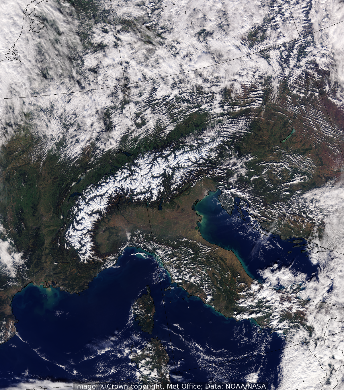
This image, acquired from the VIIRS (Visible Infrared Imaging Radiometer Suite) instrument on board the NOAA-21 satellite on 8 November 2023, shows snow cover on the Alps mountain range. The first snowfall of the season can be seen to have covered much of the Alps, from the mountain areas of Austria at its eastern end and right across to the south-western end, near the French/Italian border north of Nice.
Credits: Image: © Crown copyright, Met Office, Data: NOAA/NASA.
October 2023 - Solar eclipse over the Americas
14 October 2023
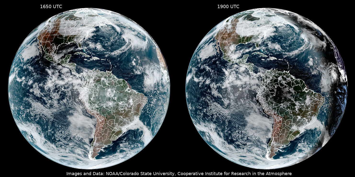
The images above show two snap-shots of the Earth's disc, and the Americas in particular, during an annular solar eclipse that took place on 14 October 2023. These events occur when the Moon passes between Earth and the Sun, causing the Sun to be partially obscured when viewed from certain places on the Earth's surface. These day-time images are created from visible channels of the Advance Baseline Imager (ABI) instrument on GOES-16, a geostationary satellite operated by NOAA, with the combination of channels providing a view near to what the human eye would see.
The left-hand image, acquired at around 1650 UTC, shows the shadow of the Moon over the central southern states of the US, particularly Texas, Oklahoma, Arkansas and Louisiana. The right-hand image was acquired just over two hours later, and shows that the Moon's shadow had moved to the northern part of South America (mainly Colombia, Venezuela and north-west Brazil) by this time.
Credits: Images and Data: NOAA/Colorado State University, Cooperative Institute for Research in the Atmosphere.
September 2023 - Storm Agnes
27 September 2023
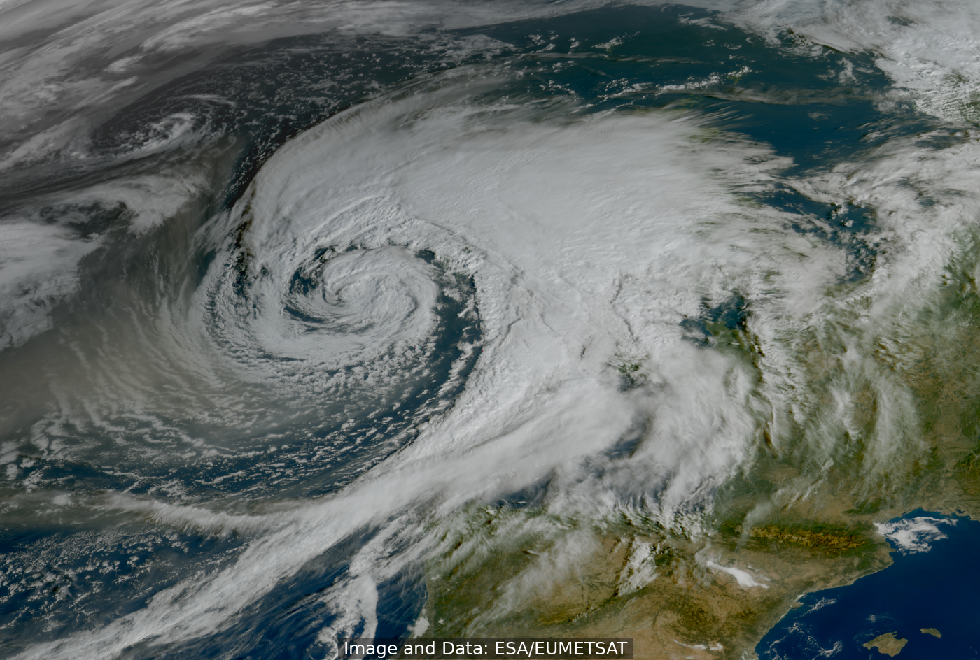
The image above is a true-colour composite of north-west Europe, taken during the morning of 27 September 2023 from the FCI (Flexible Combined Imager) instrument on board the first Meteosat Third Generation Imager satellite (MTG-I1). It shows the passage of Storm Agnes across the British Isles, bringing widespread strong winds and heavy rain to much of Scotland, north-west England and Wales. Yellow warnings for wind and rain were in force for much of the UK through Wednesday afternoon and evening, and wind gusts in excess of 80 mph were observed in northwest Wales.
Also of interest here is the appearance of smoke (seen as the sandy light brown colours in the air behind the cold front to the left-hand side of the image) that had been transported across the Atlantic from the recent Canadian wild-fires.
At the time of writing, the FCI instrument is still in a pre-operational commissioning phase, and images such as the above are not yet available to National Meteorological Services such as the Met Office on a routine basis. However, such images represent a good appetiser for what we can expect to receive regularly in the coming months and years.
Credits: Image and Data: ESA/EUMETSAT.
August 2023 - Wildfires in Greece
22 August 2023
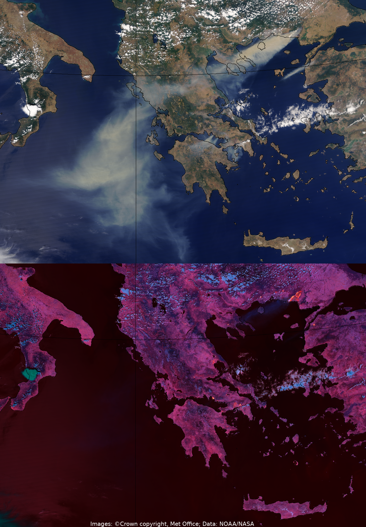
July and August 2023 saw a large number of wildfires in Greece, across many parts of the Greek mainland and also on several islands. The images above are taken from one of the most notable days, when smoke from a huge fire near the north-eastern Greek port of Alexandroupoli (reported as being the largest wildfire ever recorded in the EU) covered large areas of Greece, the Aegean and the central Mediterranean.
The images above, captured on 22 August 2023, come from the NOAA/NASA Suomi-NPP satellite, a polar-orbiting satellite which collects data while circling the Earth passing over the north and south poles. The upper image, created from the VIIRS instrument on this satellite, is a true colour image showing that thick smoke plumes (seen as a sandy light brown colour) from the Alexandroupoli fire have covered the northern Aegean Sea and spread across northern Greece and out over the Mediterranean to the west. It is also possible to see smaller smoke plumes emanating from fires near Athens, to the north of the Gulf of Corinth, and also in north-west Turkey.
The lower image, a false-colour composite that uses three near-infrared channels on the same instrument, shows the thermal anomalies associated with all of the above-mentioned fires, with the yellow colours indicating the hottest areas associated with the most severe concurrent burning conditions.
Credits: Image: © Crown copyright, Met Office, Data: NOAA/NASA.
July 2023 - Tropical cyclone Khanun
31 July 2023
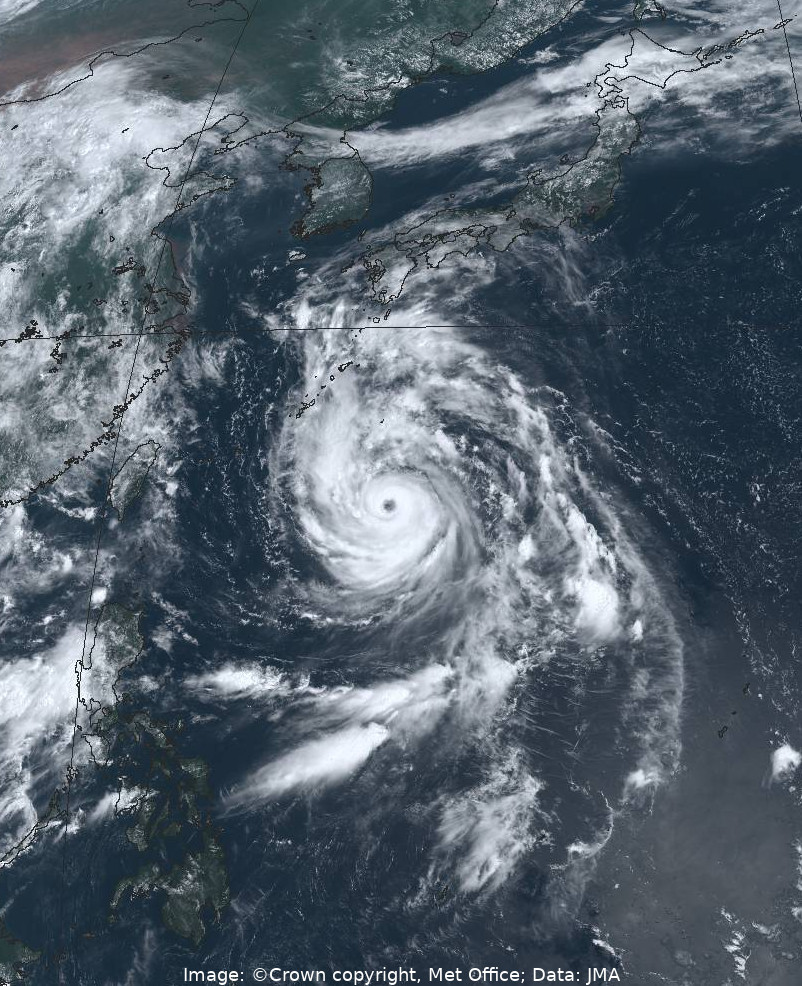
Khanun was a powerful, long-lived tropical cyclone that moved slowly and erratically across Japan's Ryukyu Islands and up the east coast of Korea in early August 2023, causing widespread disruption in both countries. The above image, a true-colour composite from JMA's Himawari-9 satellite, was captured on 31 July 2023, relatively early in the lifetime of the cyclone, when it was still situated well to the south of the Ryukyu Islands and its wind speeds were near their peak, the equivalent of a Category 4 Atlantic hurricane.
Credits: Image: © Crown copyright, Met Office, Data: JMA.
June 2023 - Cumulus clouds, Canadian wild-fire smoke and a phytoplankton bloom
29 June 2023
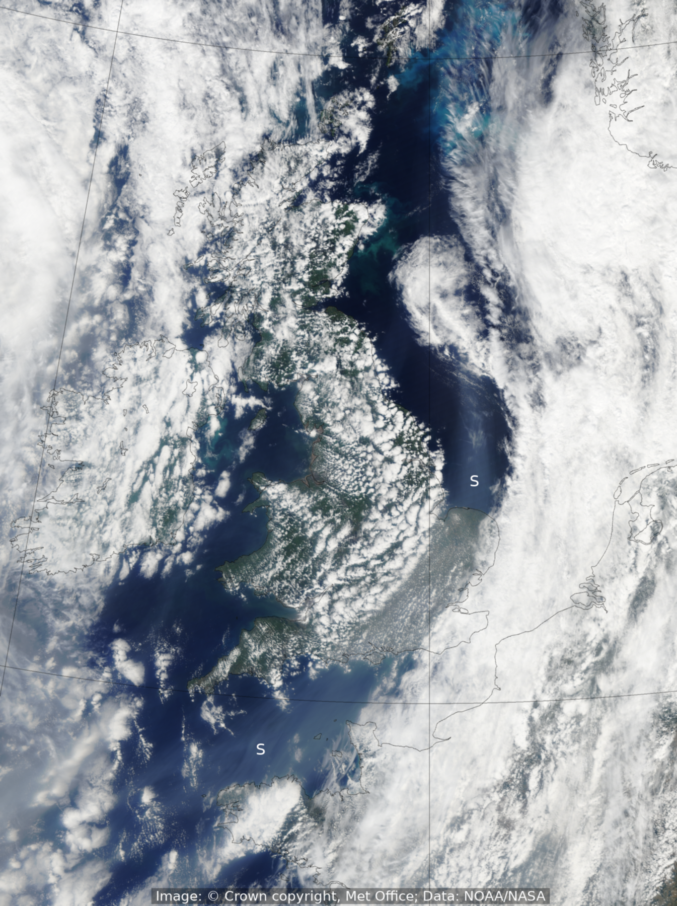
This image comes from the VIIRS (Visible Infrared Imaging Radiometer Suite) instrument on the NOAA/NASA NPP satellite, and shows a true-colour visible picture of the United Kingdom around the middle of the day on 29 June 2023. An active cold front had moved southeastwards overnight, bringing spells of heavy rain to many southern and eastern parts of England. Once the front had passed through, most UK areas experienced cooler, clearer conditions, and the widespread areas of shallow cumulus clouds seen in the image above allowed sunny spells for most, although some showers remained in central and western Scotland for much of the day.
Behind the cold front, stretching from just north of the Britanny Peninsula, across South-East England and into the North Sea above East Anglia (and indicated by the letter S in the image), a plume of smoke from the recent Canadian wild-fires can be seen, after having made its way across the Atlantic Ocean during the preceding days.
Also apparent in the image is a large area of phytoplankton bloom to the south and east of the Shetland Islands. These blooms often occur in the shallow waters of the North Sea at this time of year as sunlight levels increase, the warm ocean temperatures helping these microscopic marine algae to synthesise their own food via chlorophyll, and forming dazzling turquoise displays visible to satellites.
Credits: Image: © Crown copyright, Met Office, Data: NOAA/NASA.
May 2023 - First pictures from MTG-I1 Flexible Combined Imager
18 March 2023
The images above give an exciting first glimpse of the capabilities of the Meteosat Third Generation (MTG) mission, after they were revealed to the public by Europe’s meteorological satellite agency (EUMETSAT) and the European Space Agency (ESA) for the first time on 4 May 2023. The first satellite in the new generation of European weather satellites, MTG-I1 was launched on 13 December 2022, and its data will be disseminated to meteorological services in Europe and beyond by the end of 2023 for operational use in weather forecasting and elsewhere. The top picture shows a true-colour, full Earth disc image captured by MTG-I1's Flexible Combined Imager (FCI) instrument on 18 March 2023. The lower image shows higher-resolution data from the same view, centred over the central Mediterranean. It demonstrates the FCI's greatly improved ability to capture crisp details such as wave clouds over eastern Libya, snow cover on the Alps, and sediment in the shallow waters along the coast of Italy, all features which are not as clearly visible, or not visible at all, in imagery from the current Meteosat Second Generation instrumentation.
With greater resolution and improved frequency of imagery received from MTG-I1, our meteorologists will be able to better monitor rapidly-developing weather conditions as they unfold. This first MTG satellite will be joined by two further satellites in the coming years. This will give a three-satellite constellation bringing huge benefit to weather forecasting, providing situational awareness, and bringing revolutionary new data from geostationary orbit for nowcasting and NWP.
Credits: MTG-I1 FCI data processed and visualised by ESA and EUMETSAT.
April 2023 - Fires over Southeast Asia
7 April 2023
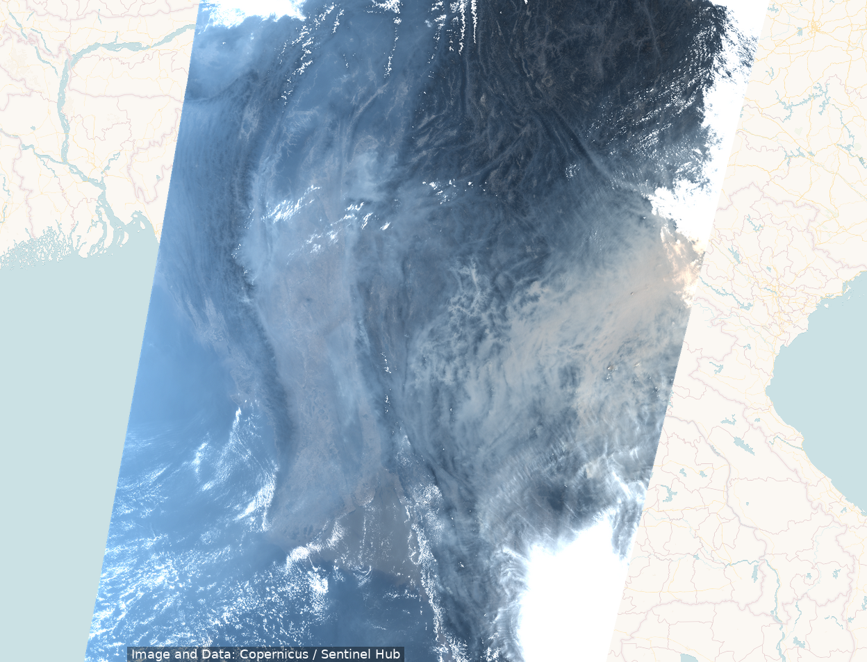
The picture above shows a true-colour image of Southeast Asia on 7 April 2023, where hundreds of fires, scattered across Myanmar, Thailand, Laos and Vietnam, caused thick grey clouds of smoke to blanket much of the region. In this image, Laos is seen to be particularly badly affected. At this time of year near the end of the dry season, most of these fires would have been lit for agricultural and land management purposes, but in this instance they intensified and spread to such an extent that the resulting air pollution posed a major threat of the health of humans and animals across much of the region.
The image comes from OLCI (the Ocean and Land Colour Instrument) on the Copernicus Sentinel-3A satellite, a polar-orbiting satellite which collects data while circling the Earth in an orbit passing over the north and south poles.
Credits: Copernicus Sentinel-3 OLCI data, processed by the Sentinel Hub.
March 2023 - Spring equinox
21 March 2023
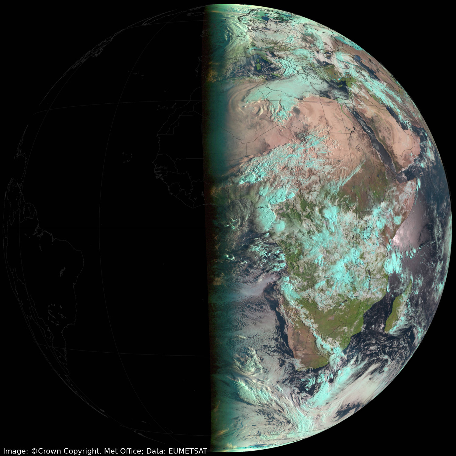
This image was taken from Meteosat-11 (the European geostationary weather satellite positioned above the equator at 0 degrees longitude) at around 0600 UTC on 21 March 2023, just hours after the spring (or vernal) equinox. At this time of day, we see the Earth's eastern hemisphere illuminated by sunlight entirely, with the western hemisphere completely in darkness. This particular type of image uses a combination of channels that provides a view near to what the human eye would see, except that ice clouds show up as a cyan colour. A couple of hours after this image was taken, EUMETSAT performed an operational swap, with the Meteosat-10 satellite taking over duties for the Earth full-disc service, and Meteosat-11 being assigned to the rapid-scanning service over the northern-most portion of the Earth's disc.
Credits: Image: © Crown copyright, Met Office; Data: EUMETSAT
February 2023 - Aurora Borealis
27/28 February 2023
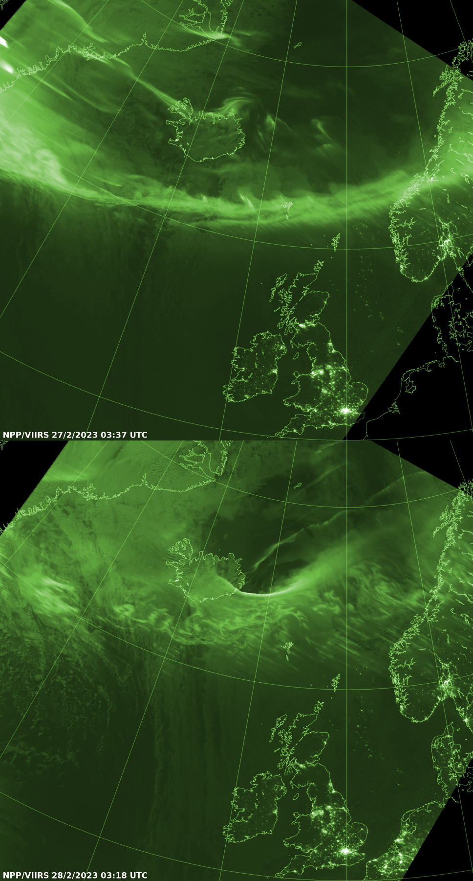
Here are a couple of night-time images from the day-night band (DNB) of the VIIRS instrument on the NOAA/NASA Suomi NPP polar-orbiting satellite, showing the spectacular Aurora Borealis to the north of the UK on 27 and 28 February 2023 (with the Aurora being seen as the brighter green swathes in the upper portion of each image). The DNB detects relatively low light levels at night-time, and city lights, roads and oil platforms can also be seen further south. The green colouration used in this image is chosen to highlight the brighter parts of the image more effectively.
Credits: Image: © Crown copyright, Met Office; Data: NOAA/NASA
January 2023 - Fog in northern Italy and snow over the Central Alps
6 January 2023
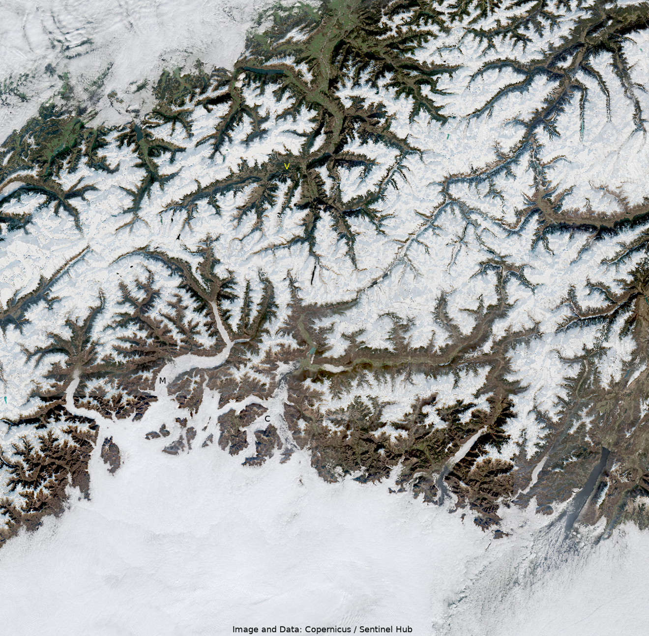
The picture above shows a true-colour image of northern Italy and the Central Alps from the morning of 6 January 2023. At the bottom of the image, we see the large, flat expanse of the Po Valley plain completely covered by fog and low cloud. We also see tendrils of fog penetrating northwards into the mountain valleys just to the north of the plain, and also over Lake Maggiore and Lake Como (labelled as M and C respectively in the image).
Also of interest is the relative lack of snow in some of the Swiss Alpine valleys further north. For example, the valleys and lower slopes adjacent to the river Vorderrhein (the Anterior Rhine, labelled as a yellow "V" in the upper portion of the image) are seen to be free of snow, an unusual occurence for this time of year.
The image comes from the Copernicus Sentinel-2A satellite, a polar-orbiting satellite which collects data while circling the Earth passing over the north and south poles. One of the images we can create from the Multi-Spectral Imager (MSI) instrument on this satellite is a true colour image, enabling us to see the land, lakes, snow, clouds and fog from space much as they would appear to the human eye.
Credits: Copernicus Sentinel-2 data, processed by the Sentinel Hub.

