New Temperature Records for the UK.
Author: Press Office
15:33 (UTC) on Sat 1 Jan 2022
Mild spell has led to provisional new temperature records for New Year's Eve and January for the UK but temperatures are now starting to trend down.
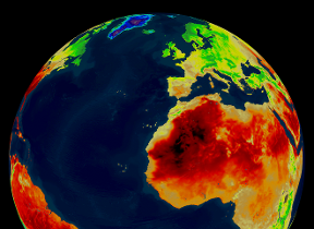
The extremely mild spell is driven by a flow of warm, moist air pushing across the UK from the Canary Islands and further south in the Atlantic and has resulted in the unusual situation of one weather system breaking weather records for two days in separate calendar years. As well as mild temperatures it has also brought cloud and outbreaks of rain for some.
This spell has led to a number of provisional records being set both yesterday and today (1st Jan 2022). 16.5 C was reached at Bala on 31st December 2021 which is a New Year’s Eve record for the UK and Wales.
All other UK countries also set New Year’s Eve daily maximum temperature records. Keswick in England reached 15.9 C, Kinlochewe in Scotland reached 16.1 C, and Magilligan reached 15.0 C in Northern Ireland.
A daily minimum temperature of 13.2 C recorded at Chivenor, in Devon is provisionally a new UK and England record for January. This beats the previous UK record of 13.1C set at Magilligan (Londonderry) in 2016 and the previous English record of 13.0C set at London St James Park in 2008.
There is also a new Welsh January daily minimum temperature record with Trawsgoed (Dyfed) recording 12.8C beating the previous record of 12.5C set at Gogerddan (Dyfed) in 2016.
New Years Day has also seen very mild temperatures with 16.3 C recorded at St James Park. This beats the previous record for New Years Day of 15.6 C at Bude (Cornwall) in 1916 setting another provisional record.
The record breaking warmth over the #NewYear2022 is thanks to a flow of warm subtropical air from the Azores🌡️
— Met Office (@metoffice) January 1, 2022
But the weather is set to briefly turn wintry this week with cold winds originating from the Arctic leading to overnight frosts, and snow for some by Tuesday😰❄️ pic.twitter.com/Vr9yvtOAvy
How long will the mild weather last?
Met Office Chief Forecaster, Steve Ramsdale, said: “We’re now past the peak of the high temperatures over the UK of this current spell. Whilst it is expected to stay mild for the rest of the weekend, we are seeing a trend downwards in temperatures with notably colder weather coming into the north from early on Monday.“
“This colder air is expected to push southwards into Tuesday bringing wintry showers and frosts. Wind and snow warnings have now been issued for parts of Scotland associated with this change. This cold spell is temporary before we see a return to weather conditions coming from the Atlantic, bringing further bouts of strong winds and rain to the UK.”
Check the latest forecast for your area on our website, by following us on Twitter and Facebook, as well as on our mobile app which is available for iPhone from the App store and for Android from the Google Play store. Keep track of current weather warnings on the weather warning page.


