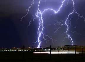
Heat and thunderstorms on the horizon
Temperatures are expected to rise by the start of next week, but there will also be the threat of thunderstorms for some as the warm weather breaks down.
Before that, sunny spells will develop widely across the country on Friday, with Scotland and Northern Ireland seeing some showers, accompanied by a brisk breeze.
There will be sunshine and blustery showers in the northwest this afternoon 🌦️🌬️
— Met Office (@metoffice) August 9, 2024
Meanwhile, feeling pleasantly warm in the best of the sunshine, and with lighter winds further southeast ⛅ pic.twitter.com/L971pbA94k
Cloud and patchy rain will affect parts of England and Wales on Saturday, but it will remain dry with some warm sunny spells in the far southeast. It will be brighter further north with scattered showers continuing.
Heat and humidity from Sunday
Sunday is when we expect to see temperatures increasing, particularly in the south and east.
Met Office Deputy Chief Meteorologist, Dan Holley, said: “We expect to see a relatively brief hotter and more humid spell of weather for Sunday and Monday, before these hotter conditions recede on Tuesday, allowing more unsettled conditions to return.
“This change to hotter conditions is caused, in part, by the effects of Tropical Storm Debby in North America. Debby is helping to strengthen the jet stream, causing it to meander over the Atlantic. This will allow hot air over France to move into the UK later this weekend, and early next week.”
Temperatures will climb over the next few days 🌡️📈
— Met Office (@metoffice) August 9, 2024
Scotland and Northern Ireland will see some warm weather, but it is across England and Wales where the heat will build most notably
Temperatures are likely to peak in the low to mid 30s Celsius in the southeast on Monday pic.twitter.com/iJW9ZxGrXw
The highest temperatures are expected in parts of central, east and southeast England, peaking on Monday with maxima over 30°C widely and possibly 33-34°C in some places. This will be accompanied by some high nighttime temperatures and humidity, especially on Sunday night in southern and western areas.
Elsewhere, while Sunday will be a fine day for much of Scotland and Northern Ireland, here temperatures will remain closer to average during this spell.
Pollen and UV levels will increase as we see temperatures rise. Find the latest UV advice and pollen count.
Thunderstorms for some
“Along with the rise in temperatures, there is also an increasing threat of heavy rain and thunderstorms on Sunday night and into Monday. This looks most likely across portions of Wales, northern England, Northern Ireland and southern and eastern Scotland, but the advice is to keep up to date with the latest forecast and any warnings by checking our website or app.” Met Office Deputy Chief Meteorologist, Dan Holley.
Further ahead
Although the southeast may still cling on to some heat on Tuesday, the hot air mass will likely become displaced by fresher conditions. Things then look to become unsettled once again, with occasional Atlantic frontal systems or showers moving through at times. Between these systems though, there will be sunshine on offer, with temperatures returning closer to average.
You can find the latest forecast on our website, on YouTube by following us, on Twitter and Facebook, as well as on our mobile app which is available for iPhone from the App store and for Android from the Google Play store.


