

Satellite image of the month
Explore satellite imagery from around the world, showcasing weather in action, with insights from the Space Applications team on how we create these images.
November 2024 - Reykjanes Peninsula eruption
21 November 2024
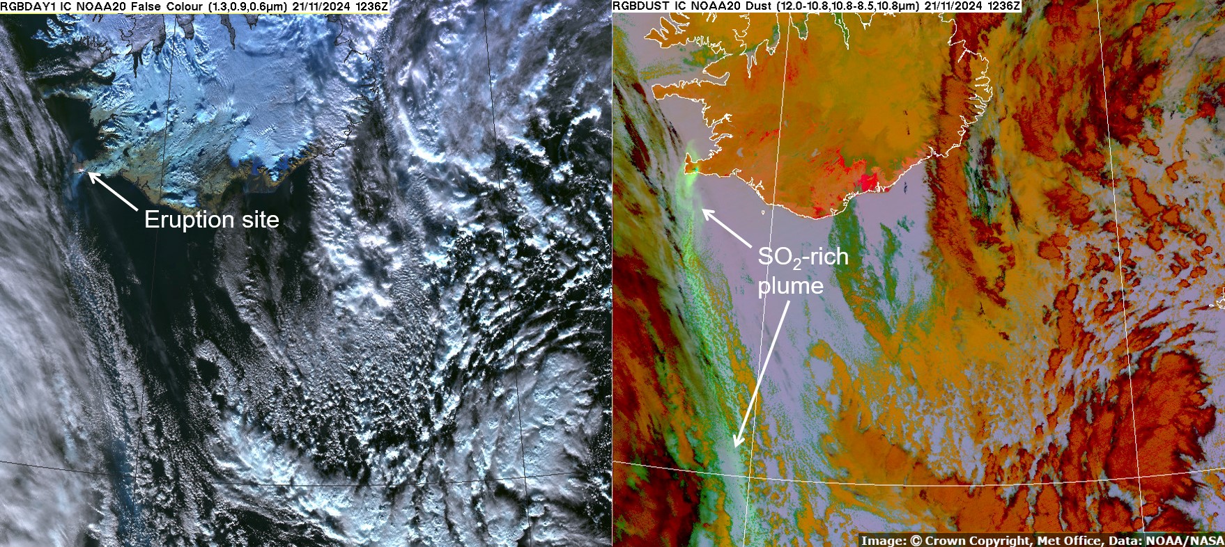
On 20th November activity on the Reykjanes Peninsula intensified with an eruption consisting of lava flows, lava fountaining and a volcanic plume. It was the latest in a series of eruptions in the region, along the Sundhnúkur crater row. These started in February 2021 and have caused extensive damage and upheaval in the region.
These two images from November 21st were captured by the Visible Infrared Imager Radiometer Suite (VIIRS) on the NOAA-20 satellite. Using different combinations of channels from the instrument can draw out different information as illustrated here. The left-hand image is made using a number of visible and Near-Infrared channels to produce a false-colour image which shows a hotspot where the eruption is ongoing, and a faint bluish volcanic plume, which can just be distinguished from the whiter cloud, and darker ocean as it advects southwards. The right-hand image is a product created using thermal infrared channels and channel differences. This product is useful for identifying dust and volcanic ash in the atmosphere. In this case the volcanic plume can be more easily seen and shows up as a vivid light green colour. This colour indicates that the plume is rich in sulphur dioxide.
Credits: Image: © Crown copyright, Met Office; Data: NOAA/NASA
October 2024 - Severe flooding in Spain
30 October 2024
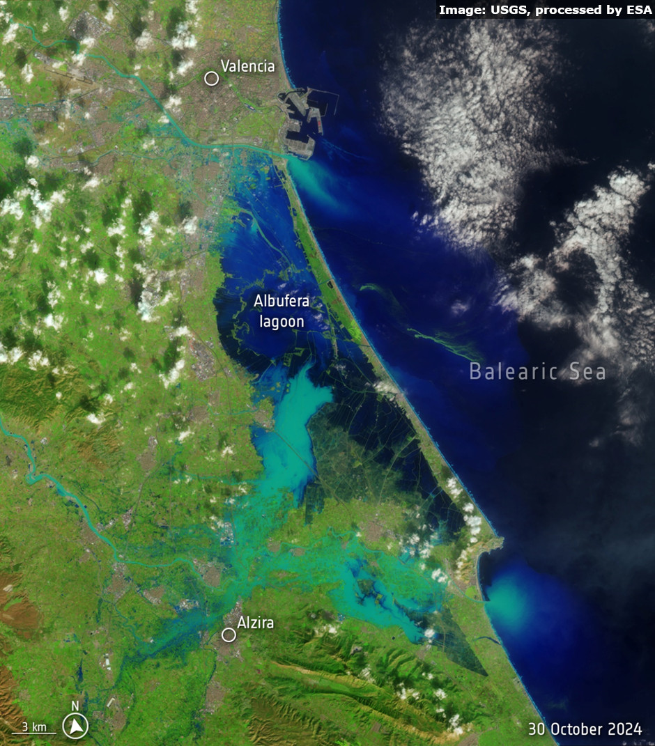
This image from the US Landsat-8 satellite captures the severe flooding that devastated eastern parts of Spain, particularly around Valencia. Prolonged torrential rain led to widespread flash flooding. Such imagery can provide emergency responders with crucial information to support rescue efforts and recovery operations.
Credits: Image: USGS, processed by ESA
September 2024 - Arctic Weather Satellite
14 September 2024
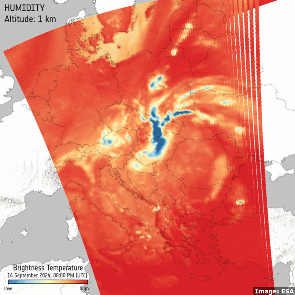
A new European Space Agency (ESA) weather satellite, launched in August, delivered its first images in September. The Arctic Weather Satellite measures microwave radiation across 19 channels which can be used to provide detailed temperature and humidity profiles of the atmosphere. This early image from 14th September offers a snapshot of the humidity levels in the lower atmosphere during Storm Boris, which caused large scale damage and disruption across parts of Europe. The blue colours in the image indicate higher humidity levels, capturing the heavy rainfall from the storm. For more details see ESA - Arctic Weather Satellite’s first images capture Storm Boris.
Credits: Image: ESA
August 2024 - Thunderstorms during Paris Olympics
1 August 2024
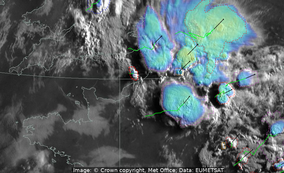
The Paris Olympics in late July to August 2024 began with wet and unsettled weather, featuring heavy rain and thunderstorms at times. On 1st August, a series of early morning thunderstorms swept over the city, causing a delay in the start of the men’s race walk event. A satellite product from that morning, which combines visible channel imagery with the infrared brightness temperature of cloud tops, provided meteorologists with insights into the severity of the storms. Additional automated storm detection techniques offered further information about storm development, tracking their recent path (green lines) and projecting their movement over the next hour (black lines). After these early August storms, the weather for the remainder of the Olympics was characterised by very hot and dry conditions.
Credits: Image: © Crown copyright, Met Office; Data: EUMETSAT
July 2024 - Hurricane Beryl
8 July 2024
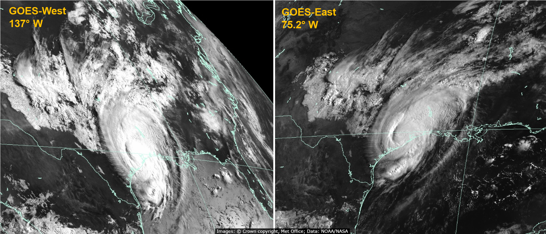
Two simultaneous satellite views of Hurricane Beryl were captured at 13:30 UTC on 8th July, shortly after it made landfall in Texas. Earlier in the month Beryl had developed to a Category 5 Hurricane causing devastation across the Caribbean. At the time of this image Beryl had reorganised to a Category 1 Hurricane, having previously weakened to a Tropical Storm. Its early-season strength was unprecedented, making Beryl the earliest Category 5 Hurricane to form in the Atlantic on record. On average, the first major hurricane (Category 3 or above) does not form until 1st September, according to the National Hurricane Center in the United States.
Credits: Image: © Crown copyright, Met Office; Data: NOAA/NASA
June 2024 - Mediterranean Dust Plume
18 June 2024
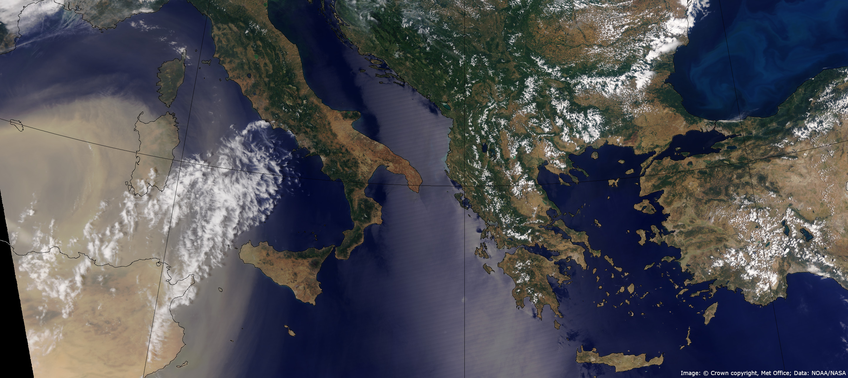
This ‘true colour’ image from NOAA-20, a polar-orbiting satellite operated by NOAA/NASA depicts a large Saharan dust plume travelling over the Western Mediterranean, passing Sardinia and heading towards Italy. This dust has been lifted from the desert by a large storm in Northern Africa. To the east of the image a phytoplankton bloom is visible in the Black Sea. The bright stripe across the centre of the image results from sun-glint, which occurs when the sun's rays are reflected directly to the satellite by the sea's surface.
Credits: Image: © Crown copyright, Met Office, Data: NOAA/NASA.
May 2024 - Phytoplankton bloom and contrails in Atlantic
11 May 2024
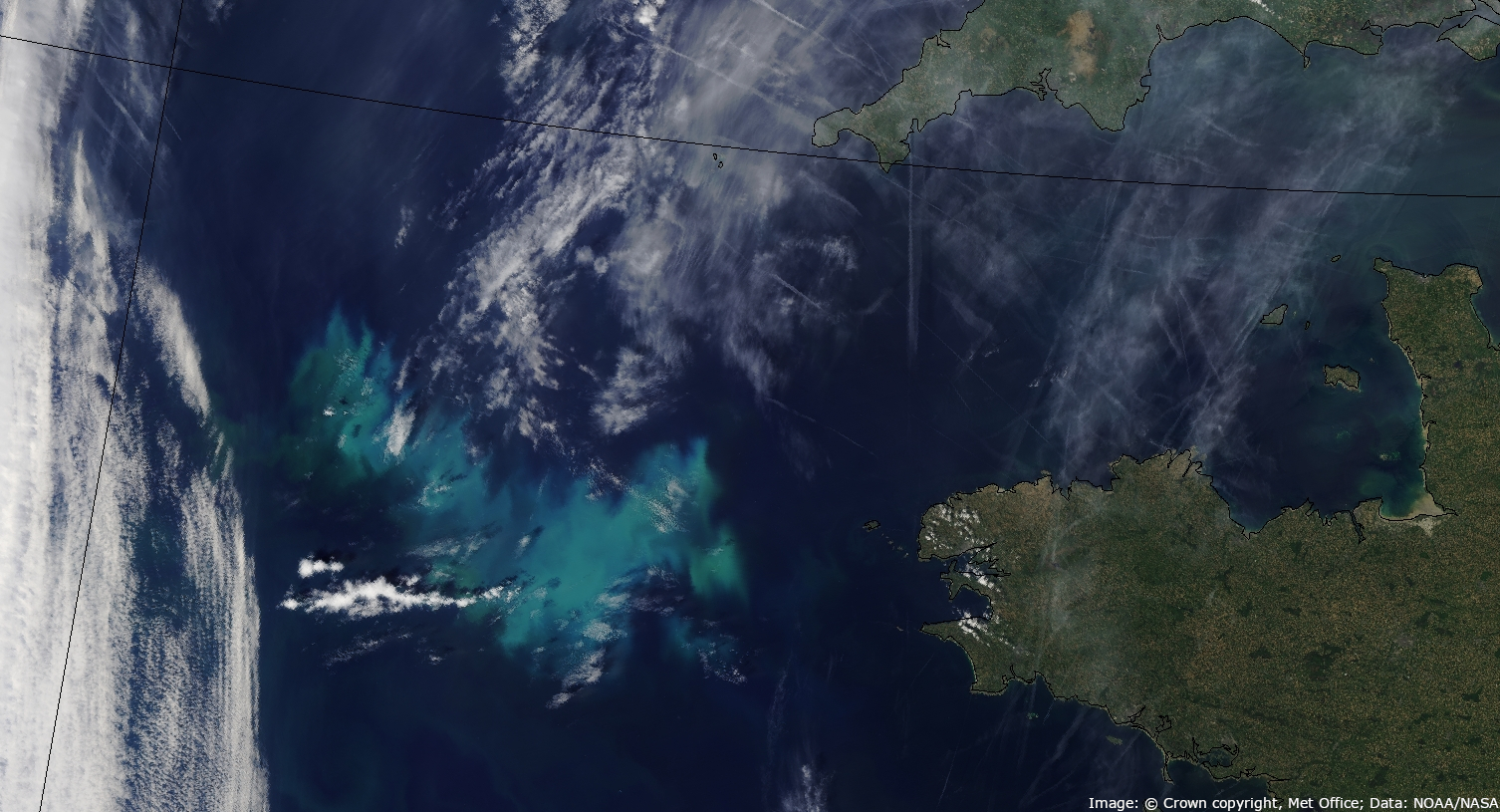
NOAA-21 captures partially clear skies over the Eastern Atlantic, near Brittany and Cornwall. The vivid blue feature west of Brittany is identified as a phytoplankton bloom, which consists of microscopic algae accumulated near the ocean's surface. Closer to Cornwall and over the English Channel, numerous aircraft contrails are visible.
Credits: Image: © Crown copyright, Met Office; Data: NOAA/NASA
April 2024 - Total Solar Eclipse
8 April 2024
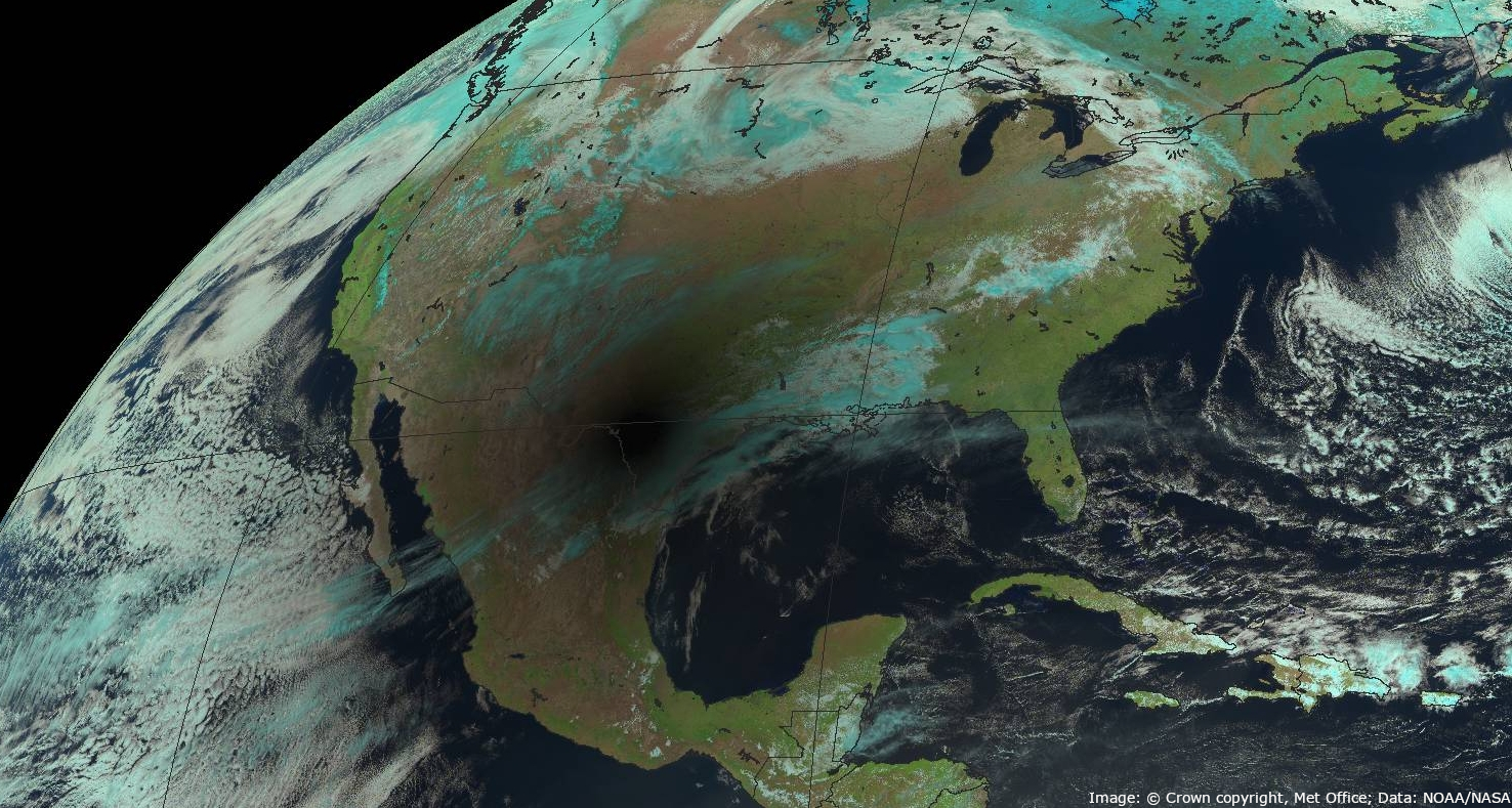
On 8th April, a total solar eclipse traversed parts of North America, plunging regions of Mexico, the USA, and Canada into darkness. This false-colour image from the NOAA/NASA operated GOES-East shows the area of totality as a dark patch. At the time of this image (18:30 UTC) the eclipse was over the border between Mexico and USA.
Credits: Image: © Crown copyright, Met Office; Data: NOAA/NASA
March 2024 - Severe weather impacts in Afghanistan
14 March 2024
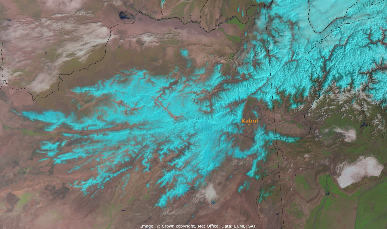
A false-color satellite image from EUMETSAT's Metop-C polar-orbiting satellite reveals extensive snow cover across Afghanistan in February, appearing in a bright cyan colour. Following a dry start to the year, the region experienced weeks of heavy rain and snow resulting in significant damage and destruction throughout the country. Although it is typical for snow to blanket Afghanistan's mountainous regions during this season, the severity of the snowfall and rainfall was greater than normal.
Credits: Image: © Crown copyright, Met Office; Data: EUMETSAT
February 2024 - Tropical Storm Akará
19 February 2024
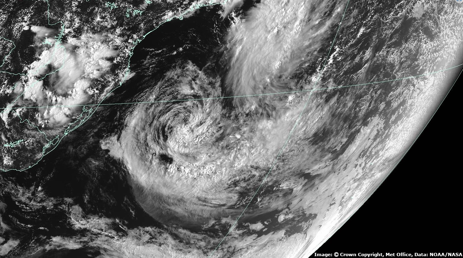
Tropical Storm Akará formed off the Brazilian coast in February. This is a rare event as tropical storms do not often form in the South Atlantic. The last such storm was in 2019. This is a visible image from NOAA/NASA’s GOES-East geostationary satellite.
Credits: Image: © Crown copyright, Met Office; Data: NOAA/NASA
January 2024 - UK named storms Isha and Jocelyn
21 January 2024
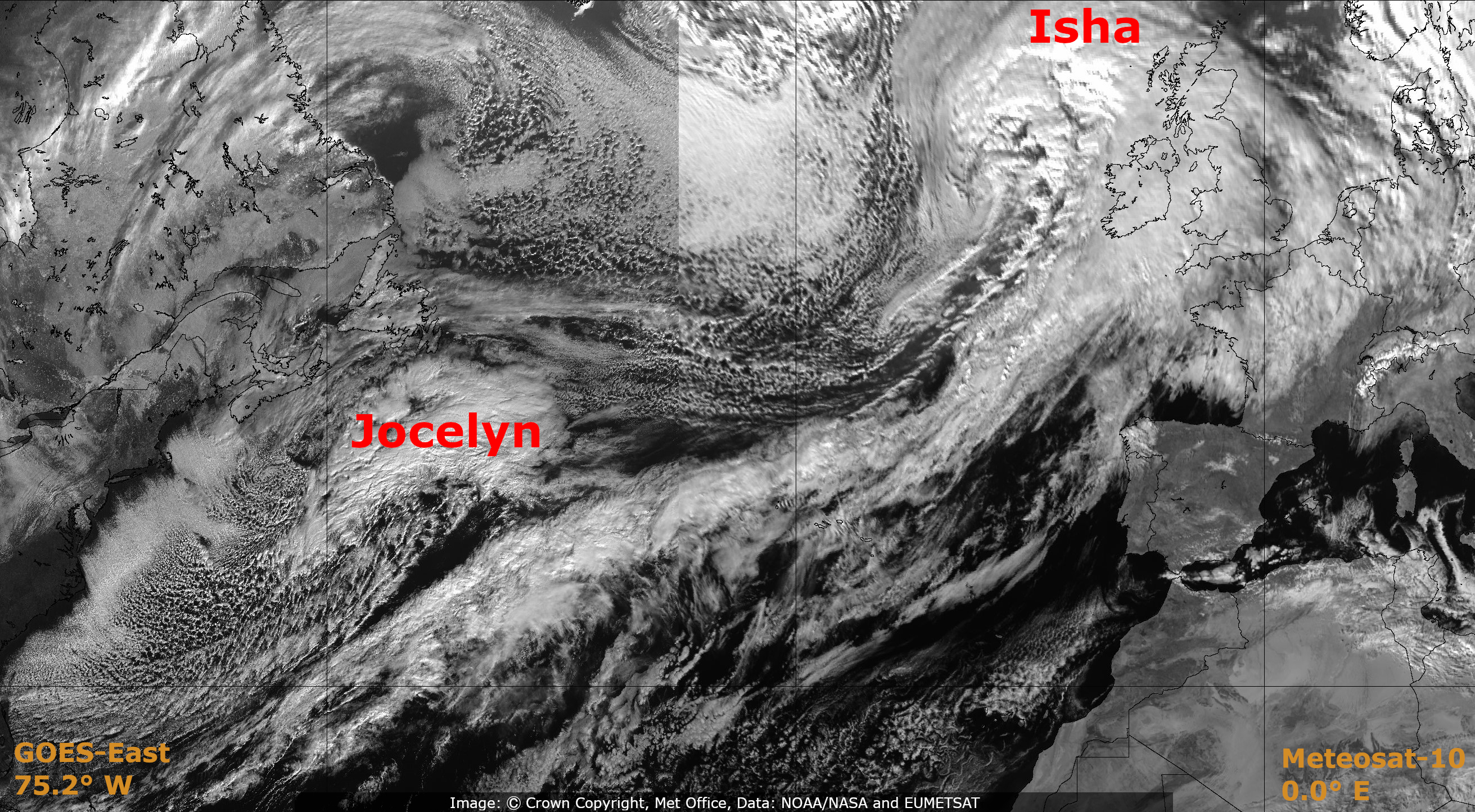 In the latter half of January, the UK experienced two successive named storms. Influenced by a strong jet stream, these storms had widespread impacts across the country. This satellite image from 14:00 UTC on 21st January shows Isha approaching the UK, while Jocelyn develops in the Western Atlantic. It is a composite of two visible channel images from different geostationary satellites at 36,000 km above the Earth: EUMETSAT’s Meteosat-10 and NOAA/NASA’s GOES-East. More detail on these storms can be found on the Met Office Storm Centre pages.
Credits: Image: © Crown copyright, Met Office; Data: NOAA/NASA (LHS) and EUMETSAT (RHS)