
Mountain weather
Mourne Mountains Mountain weather forecast table
Confidence
High confidence for the general story, becoming Low on Wednesday.
Mountain weather forecast
Mainly dry with sunny spells. Breezy.
| 06:00 | 09:00 | 12:00 | 15:00 | 18:00 | 21:00 | |
|---|---|---|---|---|---|---|
Weather (at 700m) |
|
|
|
|
|
|
Chance of precipitation (at 700m) |
<05% | <05% | 20% | 20% | 10% | <05% |
Wind direction and speed (mph)
Altitude above mean sea level
| 06:00 | 09:00 | 12:00 | 15:00 | 18:00 | 21:00 | |
|---|---|---|---|---|---|---|
| 600m |
SW
25
|
S
17
|
SW
25
|
SW
22
|
SW
23
|
SW
21
|
| 300m |
SW
10
|
S
6
|
SW
15
|
SW
14
|
SW
9
|
SW
8
|
| Valley |
SW
10
|
S
5
|
SW
14
|
SW
12
|
SW
7
|
SW
7
|
Wind gust (mph)
Altitude above mean sea level
| 06:00 | 09:00 | 12:00 | 15:00 | 18:00 | 21:00 | |
|---|---|---|---|---|---|---|
| 600m | 35 | 23 | 35 | 31 | 33 | 30 |
| 300m | 21 | 12 | 26 | 23 | 19 | 18 |
| Valley | 25 | 15 | 27 | 23 | 19 | 18 |
Altitude above mean sea level
| 06:00 | 09:00 | 12:00 | 15:00 | 18:00 | 21:00 | |
|---|---|---|---|---|---|---|
| 600m |
3°
|
3°
|
4°
|
6°
|
5°
|
4°
|
| 300m |
5°
|
5°
|
8°
|
9°
|
6°
|
5°
|
| Valley |
6°
|
6°
|
9°
|
10°
|
7°
|
6°
|
| Freezing Level |
1,100m
|
1,100m
|
1,000m
|
1,100m
|
1,100m
|
1,100m
|
Altitude above mean sea level
| 06:00 | 09:00 | 12:00 | 15:00 | 18:00 | 21:00 | |
|---|---|---|---|---|---|---|
| 600m |
-3°
|
-2°
|
-1°
|
0°
|
0°
|
-1°
|
| 300m |
2°
|
3°
|
4°
|
5°
|
4°
|
2°
|
| Valley |
3°
|
5°
|
6°
|
7°
|
5°
|
3°
|
Additional weather information
Meteorologist's view
Good walking conditions but be prepared for cold and windy conditions on the tops. Streams and rivers will be high after recent heavy rain.
Weather
Mainly dry with good bright or sunny today. A few isolated and brief showers are possible from late morning onwards. Dry and clear in the evening. Windy on the tops.
Chance of cloud-free hill tops
90%.
Low cloud and visibility
Mainly excellent visibility with just brief reductions in any showers. A few patches of cloud above 600m at first, otherwise cloud-free hills.
Mountain weather information
Weather
Dry overnight then rain arriving by morning. Rain will be heavy and persistent for most of the day combined with very strong winds to bring drenching conditions and possible flooding. Most of the rain clearing round mid-afternoon followed by blustery showers, possibly heavy and thundery.
Chance of cloud-free hill tops
Less than 10%, becoming 70% from mid-afternoon.
Maximum wind speed expected
Southerly 50 to 60mph gusts 80mph. Mobility impossible on the tops.
Temperature
- At 700m Plus 2C rising to 5C.
- Valley Plus 6C rising to 10C.
- Freezing level Above summits.
Low cloud and visibility
Extensive low cloud above 300 or 400m, poor visibility with continuous rain. Improving from mid-afternoon as cloud breaks up but poor at times in showers.
Mountain weather information
Mon 24 Feb
Sunrise:
Sunset:
Bright spells and showers, perhaps heavy and thundery. Showers turning wintry above 600m later. Cold on the tops with strong to gale force southwest winds. Freezing level above summits then 800m in evening.
Tue 25 Feb
Sunrise:
Sunset:
A colder day with sunny spells and a few showers, wintry above 400m. Breezy on the tops. Freezing level 700m.
Wed 26 Feb
Sunrise:
Sunset:
Dry start then a band of rain, preceded by summit snow, is likely to spread east. Low confidence at this stage. Strong winds likely for a time.
Updated at:
Summit specific forecast
Mountain summit forecast map
Loading map…
Key
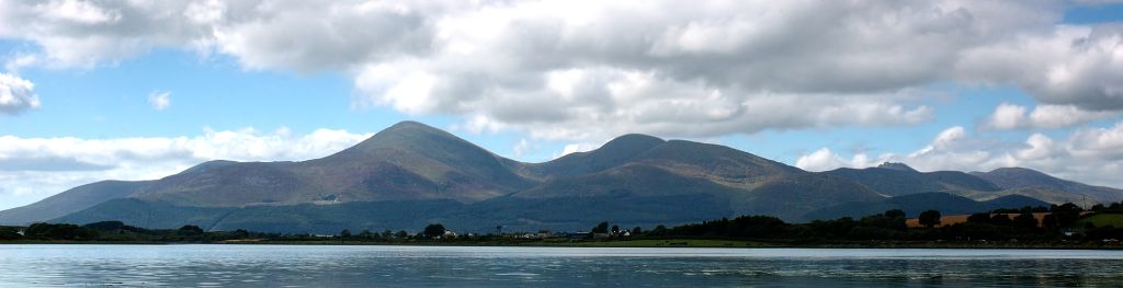
The Mourne Mountains are a granite mountain range in County Down in the southeast of Northern Ireland, is an area of outstanding natural beauty, and has been proposed as the first National Park in Northern Ireland.