
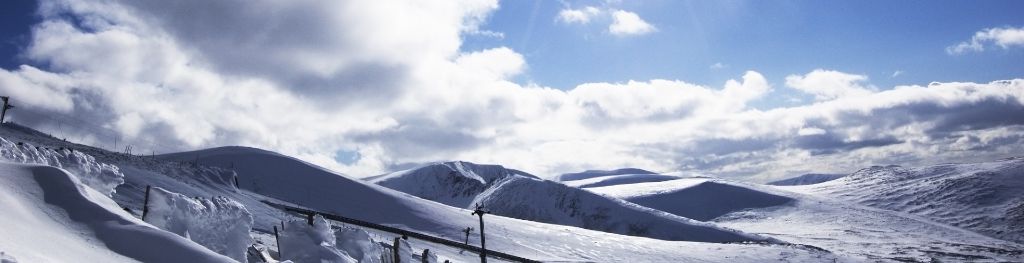
Mountain weather
South Grampian and Southeast Highlands Mountain weather forecast table
Confidence
High confidence for the general story, becoming Low on Wednesday.
Mountain weather hazards
Hazards apply at or above 300m, reflecting the more severe conditions which can occur at altitude.
 Severe Chill Effect
Wind significantly lowers the ‘feels-like’ temperature relative to the actual temperature, with even moderate winds significantly adding to the chilling effect. Strong winds can result in a severe and debilitating wind chill many degrees below the actual temperature. This effect will be enhanced in rain or wet snow. Without protection, prolonged exposure could result in frost nip or frostbite on exposed parts of the body and/or hypothermia.
Gales
Gale force winds (gusts over 50mph) make walking difficult and strenuous with a potential to be blown over by gusts. There is often a marked increase in winds through cols or on exposed ridges and summits. Distances can take longer to cover and compass bearings become harder to follow accurately.
Poor Visibility
Poor visibility presents challenging route finding conditions. Visibility could be significantly less than 50 metres in all directions with few or no visual references, especially on featureless moors or plateaux. Distances become hard to judge and cliff or cornice edges can be difficult to recognise. These conditions require good navigational skills. There is a risk of white-out conditions when mist or fog is combined with extensive snow cover.

Mountain weather forecast
Bright spells and scattered showers, wintry on the tops. Cold and windy.
| 06:00 | 09:00 | 12:00 | 15:00 | 18:00 | 21:00 | |
|---|---|---|---|---|---|---|
Weather (at 800m) |
|
|
|
|
|
|
Chance of precipitation (at 800m) |
20% | 30% | 30% | 30% | 20% | 10% |
Wind direction and speed (mph)
Altitude above mean sea level
| 06:00 | 09:00 | 12:00 | 15:00 | 18:00 | 21:00 | |
|---|---|---|---|---|---|---|
| 1100m |
SW
44
|
SW
43
|
SW
43
|
SW
41
|
SW
38
|
SW
36
|
| 900m |
SW
32
|
SW
31
|
SW
32
|
SW
30
|
SW
27
|
SW
25
|
| 600m |
SW
22
|
SW
24
|
SW
24
|
SW
23
|
SW
20
|
SW
19
|
| 300m |
SW
10
|
SW
16
|
SW
18
|
SW
17
|
SW
9
|
SW
7
|
| Glen |
SW
13
|
SW
15
|
SW
15
|
SW
14
|
SW
9
|
W
6
|
Wind gust (mph)
Altitude above mean sea level
| 06:00 | 09:00 | 12:00 | 15:00 | 18:00 | 21:00 | |
|---|---|---|---|---|---|---|
| 1100m | 51 | 51 | 54 | 51 | 48 | 46 |
| 900m | 39 | 39 | 42 | 40 | 36 | 34 |
| 600m | 36 | 39 | 41 | 38 | 36 | 34 |
| 300m | 26 | 33 | 36 | 33 | 22 | 20 |
| Glen | 30 | 32 | 30 | 28 | 19 | 16 |
Altitude above mean sea level
| 06:00 | 09:00 | 12:00 | 15:00 | 18:00 | 21:00 | |
|---|---|---|---|---|---|---|
| 1100m |
0°
|
-1°
|
-1°
|
0°
|
-1°
|
-1°
|
| 900m |
2°
|
1°
|
2°
|
2°
|
1°
|
1°
|
| 600m |
4°
|
4°
|
4°
|
4°
|
3°
|
3°
|
| 300m |
6°
|
6°
|
8°
|
7°
|
5°
|
4°
|
| Glen |
6°
|
7°
|
9°
|
9°
|
6°
|
5°
|
| Freezing Level |
1,200m
|
1,000m
|
1,000m
|
1,000m
|
1,000m
|
1,000m
|
Altitude above mean sea level
| 06:00 | 09:00 | 12:00 | 15:00 | 18:00 | 21:00 | |
|---|---|---|---|---|---|---|
| 1100m |
-9°
|
-10°
|
-10°
|
-10°
|
-10°
|
-10°
|
| 900m |
-6°
|
-6°
|
-6°
|
-6°
|
-6°
|
-6°
|
| 600m |
-1°
|
-2°
|
-1°
|
-2°
|
-2°
|
-2°
|
| 300m |
3°
|
2°
|
4°
|
3°
|
2°
|
2°
|
| Glen |
3°
|
3°
|
6°
|
6°
|
3°
|
3°
|
Additional weather information
Met Office Aberdeen meteorologist's view
Feeling cold on the tops with a severe wind chill, especially in any showers. Streams and rivers will be high due to recent heavy rain.
Weather
Bright or clear spells and scattered showers, falling as sleet or snow above 800m. The showers will be mainly over ranges to the west of the A9 with best of the sunny spells over the Aberdeenshire and Angus hills. Cold and windy conditions at height.
Chance of cloud-free hill tops
60% in west, 90% in east.
Low cloud and visibility
Occasional cloud above 600 or 700m mainly in the west with patchier cloud above 800m over the Aberdeenshire and Angus hills. Visibility mainly good away from cloud, but poor at times in any showers.
Mountain weather information
Weather
Dry overnight. Rain soon spreads east in the morning, preceded by snow above 700m. Rain will be heavy and persistent for most of the day and combined with very strong winds, will bring drenching conditions and possible flooding. Most of the rain clearing around late-afternoon followed by blustery showers, wintry on the tops and possibly heavy and thundery.
Chance of cloud-free hill tops
Less than 10%, becoming 70% from late-afternoon.
Maximum wind speed expected
Southerly or southwesterly 50 to 70mph gusts 80 to 100mph. Mobility impossible on the tops.
Temperature
- At 800m Plus 2C rising to 5C.
- Glen Plus 5C rising to 10C.
- Freezing level Above summits, falling to 1100m in evening.
Low cloud and visibility
Extensive cloud above 500 or 600m, put patchier over the Aberdeenshire hills. Poor visibility in continuous rain. Improving from late-afternoon as cloud breaks up but poor at times in showers.
Mountain weather information
Mon 24 Feb
Sunrise:
Sunset:
Bright spells and frequent showers, perhaps heavy and thundery in the west. Showers wintry above 700m then 500m later. Bitterly cold on the tops with strong to gale force southwest winds. Freezing level 900m falling to 700m.
Tue 25 Feb
Sunrise:
Sunset:
Sunny spells and a few scattered showers, wintry above 400m. Breezy on the tops. Freezing level 600 or 700m.
Wed 26 Feb
Sunrise:
Sunset:
Dry start then a band of rain, sleet or snow is likely to spread east. Strong winds likely for a time. Low confidence for details.
Updated at:
Summit specific forecast
Mountain summit forecast map
Loading map…
Key
Including South and East Cairngorms National Park, Aberdeenshire and Angus Hills, Ben Vrackie, Ben Lawers, Loch Tay and Ochils
For snow and avalanche hazard forecasts please visit Scottish Avalanche Information Service